You are here: Home > Network List > TJ - Tajikistan National Seismic Network Stations List
> Station GARM Garm, Tajikistan > Earthquake Result Viewer
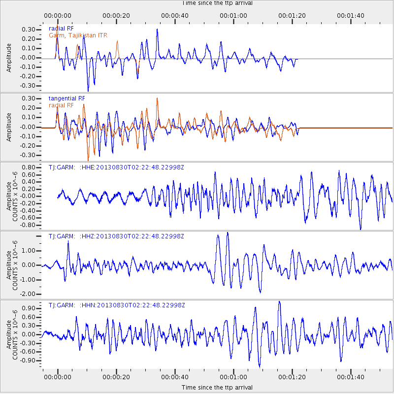
GARM Garm, Tajikistan - Earthquake Result Viewer
*The percent match for this event was below the threshold and hence no stack was calculated.
| Earthquake location: |
New Britain Region, P.N.G. |
| Earthquake latitude/longitude: |
-4.4/151.6 |
| Earthquake time(UTC): |
2013/08/30 (242) 02:11:02 GMT |
| Earthquake Depth: |
203 km |
| Earthquake Magnitude: |
5.8 MWW, 5.8 MWB, 5.8 MWC, 5.8 MWW, 5.9 MWC |
| Earthquake Catalog/Contributor: |
NEIC PDE/NEIC COMCAT |
|
| Network: |
TJ Tajikistan National Seismic Network |
| Station: |
GARM Garm, Tajikistan |
| Lat/Lon: |
39.00 N/70.32 E |
| Elevation: |
1305 m |
|
| Distance: |
86.0 deg |
| Az: |
309.458 deg |
| Baz: |
98.91 deg |
| Ray Param: |
$rayparam |
*The percent match for this event was below the threshold and hence was not used in the summary stack. |
|
| Radial Match: |
82.21156 % |
| Radial Bump: |
311 |
| Transverse Match: |
70.49855 % |
| Transverse Bump: |
356 |
| SOD ConfigId: |
626651 |
| Insert Time: |
2014-04-18 04:47:30.685 +0000 |
| GWidth: |
2.5 |
| Max Bumps: |
400 |
| Tol: |
0.001 |
|
Signal To Noise
| Channel | StoN | STA | LTA |
| TJ:GARM: :HHZ:20130830T02:22:48.22998Z | 4.6285515 | 5.827709E-7 | 1.2590783E-7 |
| TJ:GARM: :HHN:20130830T02:22:48.22998Z | 0.8056801 | 8.2725165E-8 | 1.0267744E-7 |
| TJ:GARM: :HHE:20130830T02:22:48.22998Z | 1.6981642 | 1.7655765E-7 | 1.0396971E-7 |
| Arrivals |
| Ps | |
| PpPs | |
| PsPs/PpSs | |


