You are here: Home > Network List > UW - Pacific Northwest Regional Seismic Network Stations List
> Station MRBL Marblemount, WA, USA > Earthquake Result Viewer
MRBL Marblemount, WA, USA - Earthquake Result Viewer
*The percent match for this event was below the threshold and hence no stack was calculated.
| Earthquake location: |
Northern Mid-Atlantic Ridge |
| Earthquake latitude/longitude: |
31.6/-40.6 |
| Earthquake time(UTC): |
2014/11/12 (316) 20:05:29 GMT |
| Earthquake Depth: |
10 km |
| Earthquake Magnitude: |
5.0 MW, 4.8 mb, 4.1 MS |
| Earthquake Catalog/Contributor: |
ISC/ISC |
|
| Network: |
UW Pacific Northwest Regional Seismic Network |
| Station: |
MRBL Marblemount, WA, USA |
| Lat/Lon: |
48.52 N/121.48 W |
| Elevation: |
75 m |
|
| Distance: |
61.3 deg |
| Az: |
311.552 deg |
| Baz: |
73.731 deg |
| Ray Param: |
$rayparam |
*The percent match for this event was below the threshold and hence was not used in the summary stack. |
|
| Radial Match: |
50.822308 % |
| Radial Bump: |
400 |
| Transverse Match: |
39.863476 % |
| Transverse Bump: |
400 |
| SOD ConfigId: |
3390531 |
| Insert Time: |
2019-04-14 23:16:28.029 +0000 |
| GWidth: |
2.5 |
| Max Bumps: |
400 |
| Tol: |
0.001 |
|
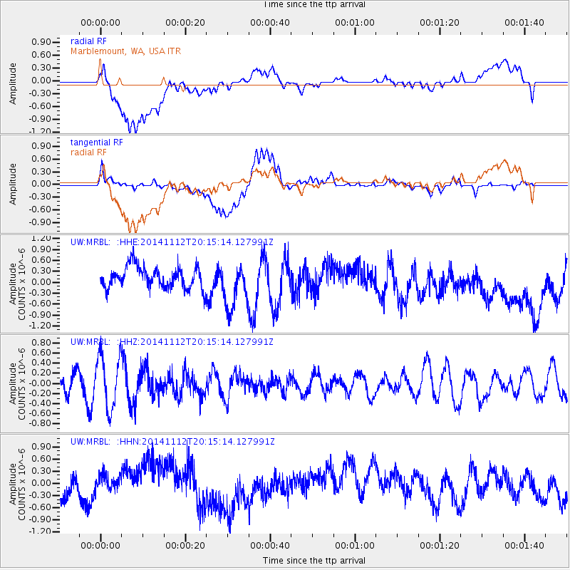
Signal To Noise
| Channel | StoN | STA | LTA |
| UW:MRBL: :HHZ:20141112T20:15:14.127991Z | 2.1329434 | 5.431771E-7 | 2.5466082E-7 |
| UW:MRBL: :HHN:20141112T20:15:14.127991Z | 0.48652306 | 1.6681739E-7 | 3.4287663E-7 |
| UW:MRBL: :HHE:20141112T20:15:14.127991Z | 2.2156968 | 6.4277594E-7 | 2.9010104E-7 |
| Arrivals |
| Ps | |
| PpPs | |
| PsPs/PpSs | |


