
MONP2 Monument Peak TA Vault, Mt. Laguna, CA, USA - Earthquake Result Viewer
| ||||||||||||||||||
| ||||||||||||||||||
| ||||||||||||||||||
|
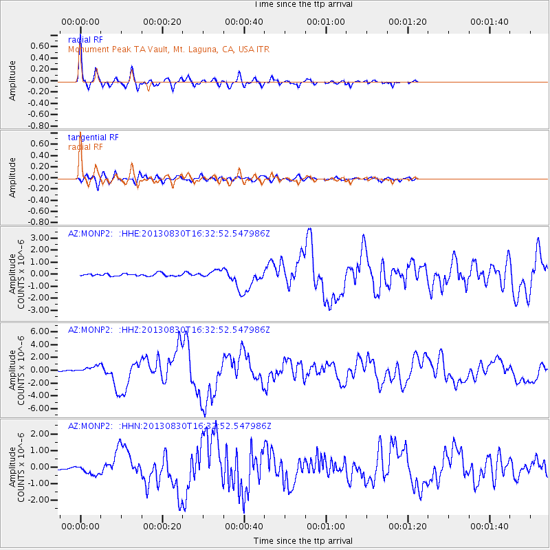
Signal To Noise
| Channel | StoN | STA | LTA |
| AZ:MONP2: :HHZ:20130830T16:32:52.547986Z | 5.9190965 | 5.513493E-7 | 9.3147534E-8 |
| AZ:MONP2: :HHN:20130830T16:32:52.547986Z | 2.4623086 | 2.9097603E-7 | 1.1817203E-7 |
| AZ:MONP2: :HHE:20130830T16:32:52.547986Z | 2.8693292 | 2.9587065E-7 | 1.0311492E-7 |
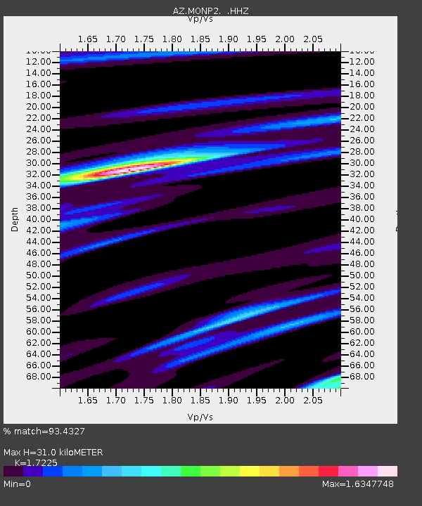
| Arrivals | |
| Ps | 3.8 SECOND |
| PpPs | 13 SECOND |
| PsPs/PpSs | 16 SECOND |

