HUMO Hull Mountain, OR - Earthquake Result Viewer
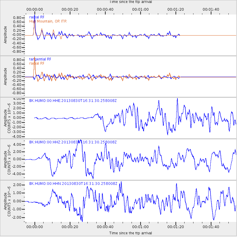
Earthquake location: Andreanof Islands, Aleutian Is.
Earthquake latitude/longitude: 51.5/-175.2
Earthquake time(UTC): 2013/08/30 (242) 16:25:02 GMT
Earthquake Depth: 29 km
Earthquake Magnitude: 7.0 MWW, 6.5 ML, 6.8 MI, 6.9 MWC, 6.9 MWB, 7.0 MWW, 7.0 MI, 7.0 MWC
Earthquake Catalog/Contributor: NEIC PDE/NEIC COMCAT
Network: BK Berkeley Digital Seismograph Network
Station: HUMO Hull Mountain, OR
Lat/Lon: 42.61 N/122.96 W
Elevation: 555 m
Distance: 36.0 deg
Az: 83.312 deg
Baz: 302.836 deg
Ray Param: 0.07686355
Estimated Moho Depth: 37.0 km
Estimated Crust Vp/Vs: 1.72
Assumed Crust Vp: 6.522 km/s
Estimated Crust Vs: 3.797 km/s
Estimated Crust Poisson's Ratio: 0.24
Radial Match: 91.845695 %
Radial Bump: 358
Transverse Match: 80.68243 %
Transverse Bump: 400
SOD ConfigId: 626651
Insert Time: 2014-04-18 04:53:08.154 +0000
GWidth: 2.5
Max Bumps: 400
Tol: 0.001

Signal To Noise

ChannelStoNSTALTA
BK:HUMO:00:HHZ:20130830T16:31:30.258008Z5.30695064.841539E-79.123014E-8
BK:HUMO:00:HHN:20130830T16:31:30.258008Z2.94785981.623639E-75.507857E-8
BK:HUMO:00:HHE:20130830T16:31:30.258008Z3.47449683.421481E-79.847414E-8
Arrivals
Ps4.4 SECOND
PpPs14 SECOND
PsPs/PpSs19 SECOND