
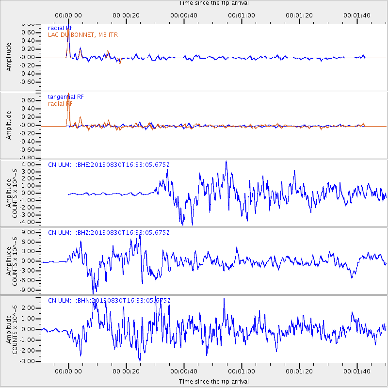
ULM LAC DU BONNET, MB - Earthquake Result Viewer
| ||||||||||||||||||
| ||||||||||||||||||
| ||||||||||||||||||
|
Signal To Noise
| Channel | StoN | STA | LTA |
| CN:ULM: :BHZ:20130830T16:33:05.675Z | 19.23907 | 2.601437E-6 | 1.3521634E-7 |
| CN:ULM: :BHN:20130830T16:33:05.675Z | 7.498454 | 9.510157E-7 | 1.2682824E-7 |
| CN:ULM: :BHE:20130830T16:33:05.675Z | 14.428429 | 1.3580076E-6 | 9.412027E-8 |
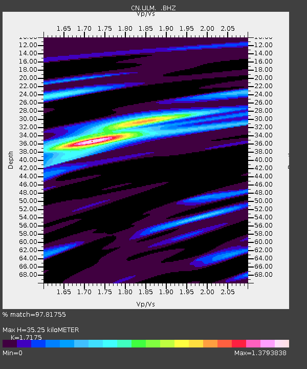
| Arrivals | |
| Ps | 4.2 SECOND |
| PpPs | 14 SECOND |
| PsPs/PpSs | 18 SECOND |

