INU Inuyama, Japan - Earthquake Result Viewer
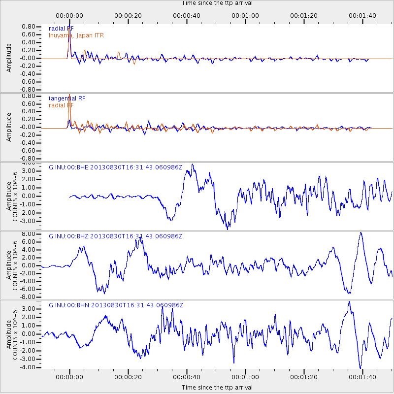
Earthquake location: Andreanof Islands, Aleutian Is.
Earthquake latitude/longitude: 51.5/-175.2
Earthquake time(UTC): 2013/08/30 (242) 16:25:02 GMT
Earthquake Depth: 29 km
Earthquake Magnitude: 7.0 MWW, 6.5 ML, 6.8 MI, 6.9 MWC, 6.9 MWB, 7.0 MWW, 7.0 MI, 7.0 MWC
Earthquake Catalog/Contributor: NEIC PDE/NEIC COMCAT
Network: G GEOSCOPE
Station: INU Inuyama, Japan
Lat/Lon: 35.35 N/137.03 E
Elevation: 132 m
Distance: 37.5 deg
Az: 263.44 deg
Baz: 49.379 deg
Ray Param: 0.07604271
Estimated Moho Depth: 48.5 km
Estimated Crust Vp/Vs: 1.77
Assumed Crust Vp: 6.461 km/s
Estimated Crust Vs: 3.64 km/s
Estimated Crust Poisson's Ratio: 0.27
Radial Match: 92.29944 %
Radial Bump: 400
Transverse Match: 67.967964 %
Transverse Bump: 400
SOD ConfigId: 626651
Insert Time: 2014-04-18 04:58:58.955 +0000
GWidth: 2.5
Max Bumps: 400
Tol: 0.001

Signal To Noise

ChannelStoNSTALTA
G:INU:00:BHZ:20130830T16:31:43.060986Z15.7014022.8106422E-61.7900581E-7
G:INU:00:BHN:20130830T16:31:43.060986Z3.82525358.847539E-72.3129287E-7
G:INU:00:BHE:20130830T16:31:43.060986Z12.9666651.5878327E-61.2245496E-7
Arrivals
Ps6.3 SECOND
PpPs19 SECOND
PsPs/PpSs26 SECOND