
TBLG Delisi, Georgia - Earthquake Result Viewer
| ||||||||||||||||||
| ||||||||||||||||||
| ||||||||||||||||||
|
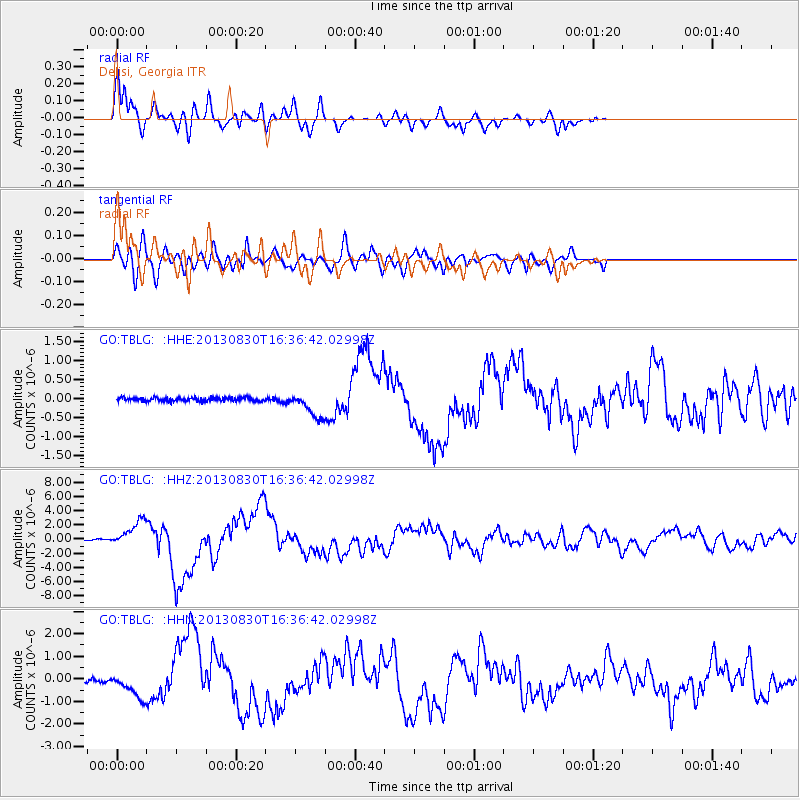
Signal To Noise
| Channel | StoN | STA | LTA |
| GO:TBLG: :HHZ:20130830T16:36:42.02998Z | 27.693386 | 1.8141502E-6 | 6.550843E-8 |
| GO:TBLG: :HHN:20130830T16:36:42.02998Z | 9.718072 | 5.4230264E-7 | 5.5803522E-8 |
| GO:TBLG: :HHE:20130830T16:36:42.02998Z | 6.8507476 | 3.2983655E-7 | 4.8146067E-8 |
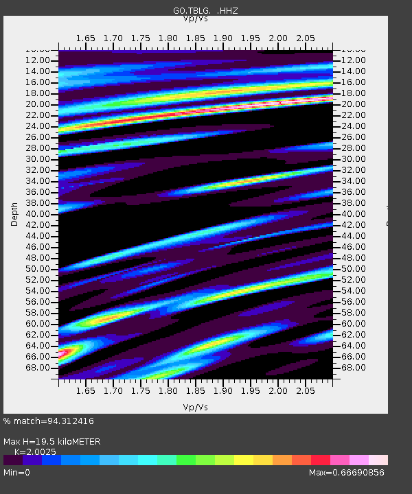
| Arrivals | |
| Ps | 3.2 SECOND |
| PpPs | 9.1 SECOND |
| PsPs/PpSs | 12 SECOND |

