
LSA Tibet, China - Earthquake Result Viewer
| ||||||||||||||||||
| ||||||||||||||||||
| ||||||||||||||||||
|
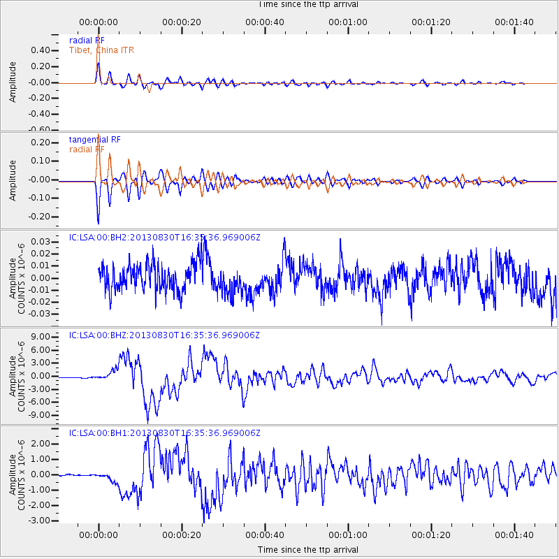
Signal To Noise
| Channel | StoN | STA | LTA |
| IC:LSA:00:BHZ:20130830T16:35:36.969006Z | 24.789347 | 1.1978723E-6 | 4.832206E-8 |
| IC:LSA:00:BH1:20130830T16:35:36.969006Z | 9.713507 | 3.0213727E-7 | 3.1104857E-8 |
| IC:LSA:00:BH2:20130830T16:35:36.969006Z | 1.103088 | 1.20252635E-8 | 1.0901454E-8 |
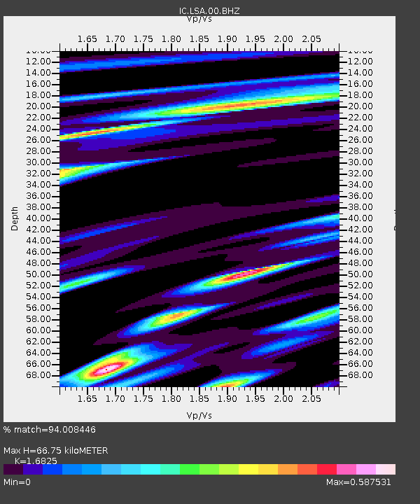
| Arrivals | |
| Ps | 7.3 SECOND |
| PpPs | 26 SECOND |
| PsPs/PpSs | 34 SECOND |

