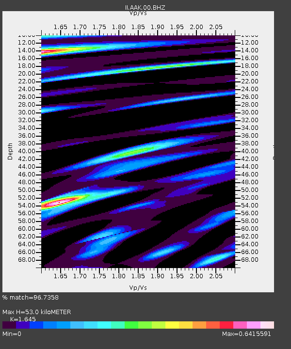
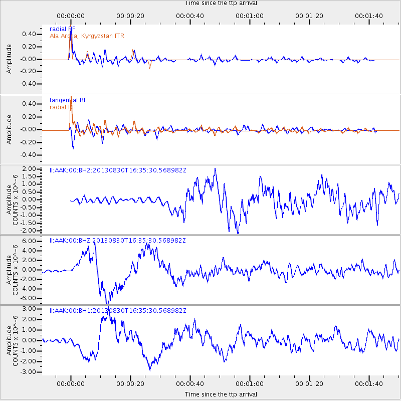
AAK Ala Archa, Kyrgyzstan - Earthquake Result Viewer

Earthquake location: Andreanof Islands, Aleutian Is.
Earthquake latitude/longitude: 51.5/-175.2
Earthquake time(UTC): 2013/08/30 (242) 16:25:02 GMT
Earthquake Depth: 29 km
Earthquake Magnitude: 7.0 MWW, 6.5 ML, 6.8 MI, 6.9 MWC, 6.9 MWB, 7.0 MWW, 7.0 MI, 7.0 MWC
Earthquake Catalog/Contributor: NEIC PDE/NEIC COMCAT
Network: II Global Seismograph Network (GSN - IRIS/IDA)
Station: AAK Ala Archa, Kyrgyzstan
Lat/Lon: 42.64 N/74.49 E
Elevation: 1645 m
Distance: 68.4 deg
Az: 311.908 deg
Baz: 39.044 deg
Ray Param: 0.056256983
Estimated Moho Depth: 53.0 km
Estimated Crust Vp/Vs: 1.64
Assumed Crust Vp: 6.306 km/s
Estimated Crust Vs: 3.833 km/s
Estimated Crust Poisson's Ratio: 0.21
Radial Match: 96.7358 %
Radial Bump: 400
Transverse Match: 92.46208 %
Transverse Bump: 400
SOD ConfigId: 626651
Insert Time: 2014-04-18 05:02:34.566 +0000
GWidth: 2.5
Max Bumps: 400
Tol: 0.001

Signal To Noise

ChannelStoNSTALTA
II:AAK:00:BHZ:20130830T16:35:30.568982Z12.973742.055056E-61.584012E-7
II:AAK:00:BH1:20130830T16:35:30.568982Z8.8436288.130179E-79.193262E-8
II:AAK:00:BH2:20130830T16:35:30.568982Z4.047454.677152E-71.1555799E-7
Arrivals
Ps5.6 SECOND
PpPs21 SECOND
PsPs/PpSs27 SECOND