TLY Talaya, Russia - Earthquake Result Viewer
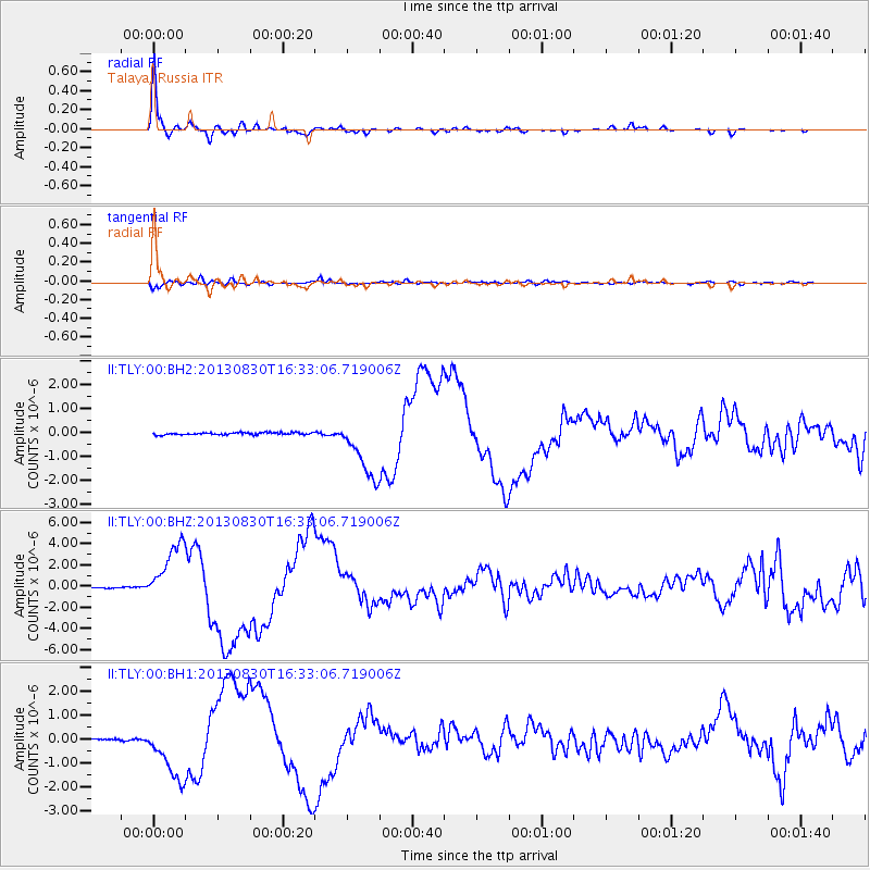
Earthquake location: Andreanof Islands, Aleutian Is.
Earthquake latitude/longitude: 51.5/-175.2
Earthquake time(UTC): 2013/08/30 (242) 16:25:02 GMT
Earthquake Depth: 29 km
Earthquake Magnitude: 7.0 MWW, 6.5 ML, 6.8 MI, 6.9 MWC, 6.9 MWB, 7.0 MWW, 7.0 MI, 7.0 MWC
Earthquake Catalog/Contributor: NEIC PDE/NEIC COMCAT
Network: II Global Seismograph Network (GSN - IRIS/IDA)
Station: TLY Talaya, Russia
Lat/Lon: 51.68 N/103.64 E
Elevation: 579 m
Distance: 47.8 deg
Az: 303.924 deg
Baz: 56.345 deg
Ray Param: 0.06968098
Estimated Moho Depth: 44.25 km
Estimated Crust Vp/Vs: 1.79
Assumed Crust Vp: 6.419 km/s
Estimated Crust Vs: 3.596 km/s
Estimated Crust Poisson's Ratio: 0.27
Radial Match: 98.13401 %
Radial Bump: 266
Transverse Match: 90.93093 %
Transverse Bump: 400
SOD ConfigId: 626651
Insert Time: 2014-04-18 05:03:04.790 +0000
GWidth: 2.5
Max Bumps: 400
Tol: 0.001

Signal To Noise

ChannelStoNSTALTA
II:TLY:00:BHZ:20130830T16:33:06.719006Z46.5004352.814401E-66.052419E-8
II:TLY:00:BH1:20130830T16:33:06.719006Z34.1042861.182474E-63.4672297E-8
II:TLY:00:BH2:20130830T16:33:06.719006Z28.9391691.2908685E-64.460627E-8
Arrivals
Ps5.7 SECOND
PpPs18 SECOND
PsPs/PpSs24 SECOND