CCM Cathedral Cave, Missouri, USA - Earthquake Result Viewer
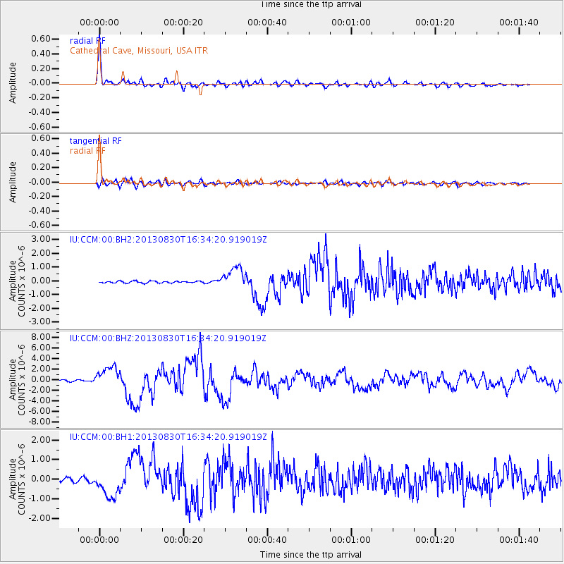
Earthquake location: Andreanof Islands, Aleutian Is.
Earthquake latitude/longitude: 51.5/-175.2
Earthquake time(UTC): 2013/08/30 (242) 16:25:02 GMT
Earthquake Depth: 29 km
Earthquake Magnitude: 7.0 MWW, 6.5 ML, 6.8 MI, 6.9 MWC, 6.9 MWB, 7.0 MWW, 7.0 MI, 7.0 MWC
Earthquake Catalog/Contributor: NEIC PDE/NEIC COMCAT
Network: IU Global Seismograph Network (GSN - IRIS/USGS)
Station: CCM Cathedral Cave, Missouri, USA
Lat/Lon: 38.06 N/91.24 W
Elevation: 222 m
Distance: 57.9 deg
Az: 67.899 deg
Baz: 312.858 deg
Ray Param: 0.06313354
Estimated Moho Depth: 40.25 km
Estimated Crust Vp/Vs: 1.68
Assumed Crust Vp: 6.498 km/s
Estimated Crust Vs: 3.862 km/s
Estimated Crust Poisson's Ratio: 0.23
Radial Match: 95.87156 %
Radial Bump: 365
Transverse Match: 83.2577 %
Transverse Bump: 400
SOD ConfigId: 626651
Insert Time: 2014-04-18 05:03:34.184 +0000
GWidth: 2.5
Max Bumps: 400
Tol: 0.001

Signal To Noise

ChannelStoNSTALTA
IU:CCM:00:BHZ:20130830T16:34:20.919019Z12.4301822.0193124E-61.6245235E-7
IU:CCM:00:BH1:20130830T16:34:20.919019Z5.66126637.1063334E-71.255255E-7
IU:CCM:00:BH2:20130830T16:34:20.919019Z12.2683047.9763373E-76.501581E-8
Arrivals
Ps4.5 SECOND
PpPs16 SECOND
PsPs/PpSs20 SECOND