CGRP Cima Grappa - Earthquake Result Viewer
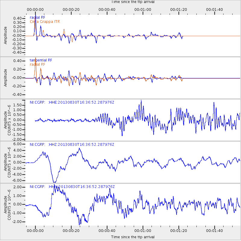
Earthquake location: Andreanof Islands, Aleutian Is.
Earthquake latitude/longitude: 51.5/-175.2
Earthquake time(UTC): 2013/08/30 (242) 16:25:02 GMT
Earthquake Depth: 29 km
Earthquake Magnitude: 7.0 MWW, 6.5 ML, 6.8 MI, 6.9 MWC, 6.9 MWB, 7.0 MWW, 7.0 MI, 7.0 MWC
Earthquake Catalog/Contributor: NEIC PDE/NEIC COMCAT
Network: NI North-East Italy Broadband Network
Station: CGRP Cima Grappa
Lat/Lon: 45.88 N/11.80 E
Elevation: 1757 m
Distance: 82.8 deg
Az: 355.053 deg
Baz: 4.422 deg
Ray Param: 0.04661911
Estimated Moho Depth: 17.0 km
Estimated Crust Vp/Vs: 2.10
Assumed Crust Vp: 6.155 km/s
Estimated Crust Vs: 2.934 km/s
Estimated Crust Poisson's Ratio: 0.35
Radial Match: 93.688416 %
Radial Bump: 400
Transverse Match: 80.79984 %
Transverse Bump: 400
SOD ConfigId: 626651
Insert Time: 2014-04-18 05:08:36.450 +0000
GWidth: 2.5
Max Bumps: 400
Tol: 0.001

Signal To Noise

ChannelStoNSTALTA
NI:CGRP: :HHZ:20130830T16:36:52.287976Z38.417691.9524355E-65.082126E-8
NI:CGRP: :HHN:20130830T16:36:52.287976Z9.4680427.076614E-77.47421E-8
NI:CGRP: :HHE:20130830T16:36:52.287976Z1.30669328.745941E-86.693187E-8
Arrivals
Ps3.1 SECOND
PpPs8.4 SECOND
PsPs/PpSs11 SECOND