059Z Ave Maria, FL, USA - Earthquake Result Viewer
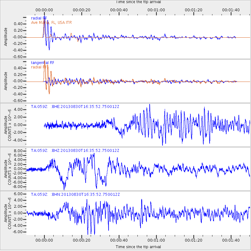
Earthquake location: Andreanof Islands, Aleutian Is.
Earthquake latitude/longitude: 51.5/-175.2
Earthquake time(UTC): 2013/08/30 (242) 16:25:02 GMT
Earthquake Depth: 29 km
Earthquake Magnitude: 7.0 MWW, 6.5 ML, 6.8 MI, 6.9 MWC, 6.9 MWB, 7.0 MWW, 7.0 MI, 7.0 MWC
Earthquake Catalog/Contributor: NEIC PDE/NEIC COMCAT
Network: TA USArray Transportable Network (new EarthScope stations)
Station: 059Z Ave Maria, FL, USA
Lat/Lon: 26.34 N/81.44 W
Elevation: 8.0 m
Distance: 72.1 deg
Az: 70.228 deg
Baz: 319.083 deg
Ray Param: 0.053855382
Estimated Moho Depth: 17.0 km
Estimated Crust Vp/Vs: 1.72
Assumed Crust Vp: 6.347 km/s
Estimated Crust Vs: 3.69 km/s
Estimated Crust Poisson's Ratio: 0.24
Radial Match: 95.907524 %
Radial Bump: 400
Transverse Match: 79.23798 %
Transverse Bump: 400
SOD ConfigId: 626651
Insert Time: 2014-04-18 05:15:01.331 +0000
GWidth: 2.5
Max Bumps: 400
Tol: 0.001

Signal To Noise

ChannelStoNSTALTA
TA:059Z: :BHZ:20130830T16:35:52.750012Z3.36861251.7547609E-65.20915E-7
TA:059Z: :BHN:20130830T16:35:52.750012Z1.89247557.471751E-73.948136E-7
TA:059Z: :BHE:20130830T16:35:52.750012Z1.70426487.130867E-74.184131E-7
Arrivals
Ps2.0 SECOND
PpPs7.0 SECOND
PsPs/PpSs9.0 SECOND