
147A Livingston, AL, USA - Earthquake Result Viewer
| ||||||||||||||||||
| ||||||||||||||||||
| ||||||||||||||||||
|
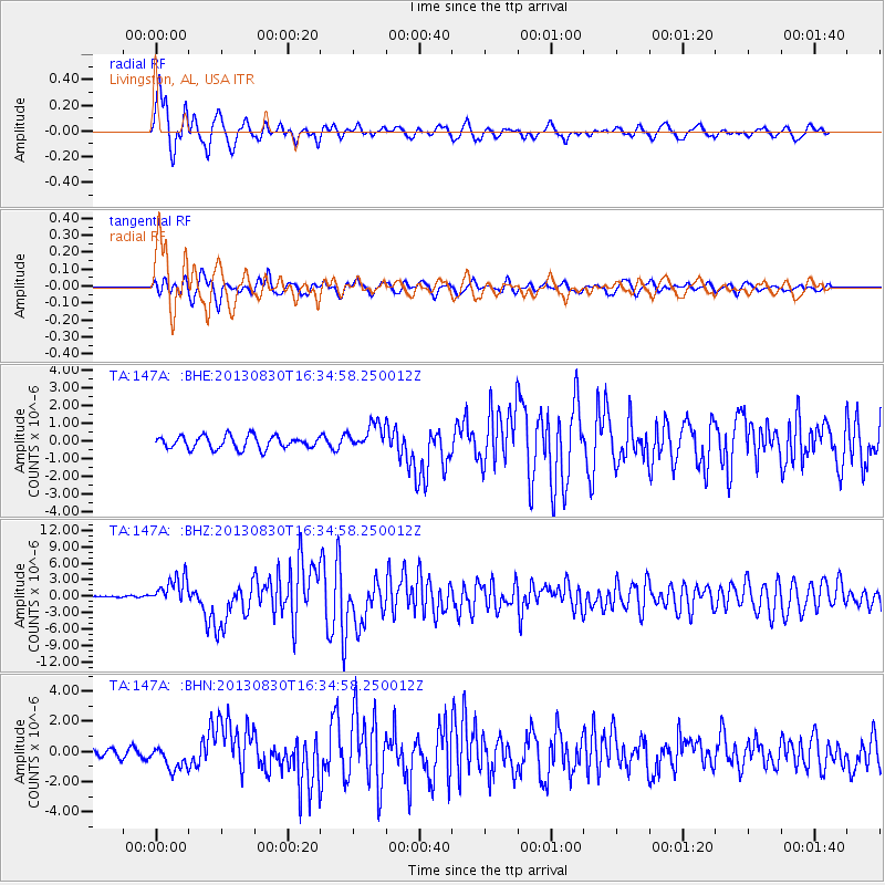
Signal To Noise
| Channel | StoN | STA | LTA |
| TA:147A: :BHZ:20130830T16:34:58.250012Z | 7.835633 | 2.8111015E-6 | 3.587587E-7 |
| TA:147A: :BHN:20130830T16:34:58.250012Z | 3.4545064 | 8.1947945E-7 | 2.3722042E-7 |
| TA:147A: :BHE:20130830T16:34:58.250012Z | 2.0105906 | 7.273768E-7 | 3.6177272E-7 |
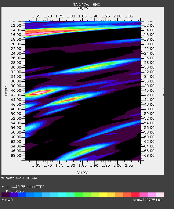
| Arrivals | |
| Ps | 4.5 SECOND |
| PpPs | 17 SECOND |
| PsPs/PpSs | 21 SECOND |

