153A Fort Valley, GA, USA - Earthquake Result Viewer
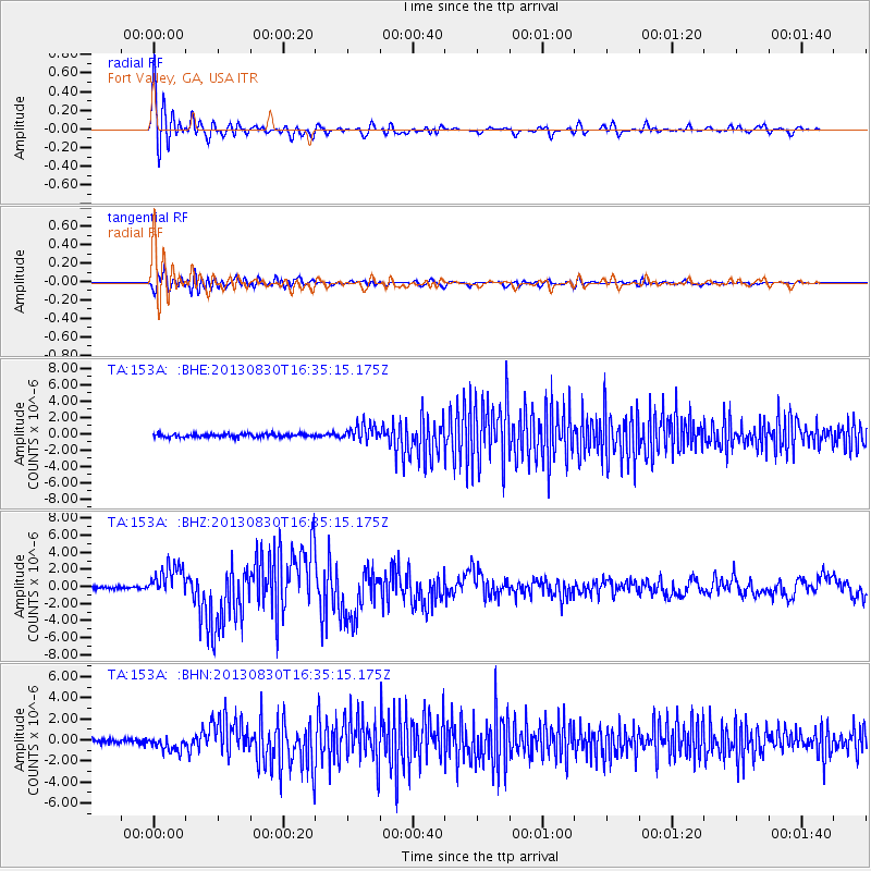
Earthquake location: Andreanof Islands, Aleutian Is.
Earthquake latitude/longitude: 51.5/-175.2
Earthquake time(UTC): 2013/08/30 (242) 16:25:02 GMT
Earthquake Depth: 29 km
Earthquake Magnitude: 7.0 MWW, 6.5 ML, 6.8 MI, 6.9 MWC, 6.9 MWB, 7.0 MWW, 7.0 MI, 7.0 MWC
Earthquake Catalog/Contributor: NEIC PDE/NEIC COMCAT
Network: TA USArray Transportable Network (new EarthScope stations)
Station: 153A Fort Valley, GA, USA
Lat/Lon: 32.66 N/83.83 W
Elevation: 160 m
Distance: 66.0 deg
Az: 67.371 deg
Baz: 316.888 deg
Ray Param: 0.057854217
Estimated Moho Depth: 18.25 km
Estimated Crust Vp/Vs: 1.60
Assumed Crust Vp: 6.565 km/s
Estimated Crust Vs: 4.103 km/s
Estimated Crust Poisson's Ratio: 0.18
Radial Match: 94.26059 %
Radial Bump: 400
Transverse Match: 81.91928 %
Transverse Bump: 400
SOD ConfigId: 626651
Insert Time: 2014-04-18 05:15:22.237 +0000
GWidth: 2.5
Max Bumps: 400
Tol: 0.001

Signal To Noise

ChannelStoNSTALTA
TA:153A: :BHZ:20130830T16:35:15.175Z12.4466371.8719469E-61.503978E-7
TA:153A: :BHN:20130830T16:35:15.175Z3.6482167.1967133E-71.9726663E-7
TA:153A: :BHE:20130830T16:35:15.175Z5.02069471.0158597E-62.0233449E-7
Arrivals
Ps1.7 SECOND
PpPs6.9 SECOND
PsPs/PpSs8.6 SECOND