
154A Montrose, GA, USA - Earthquake Result Viewer
| ||||||||||||||||||
| ||||||||||||||||||
| ||||||||||||||||||
|
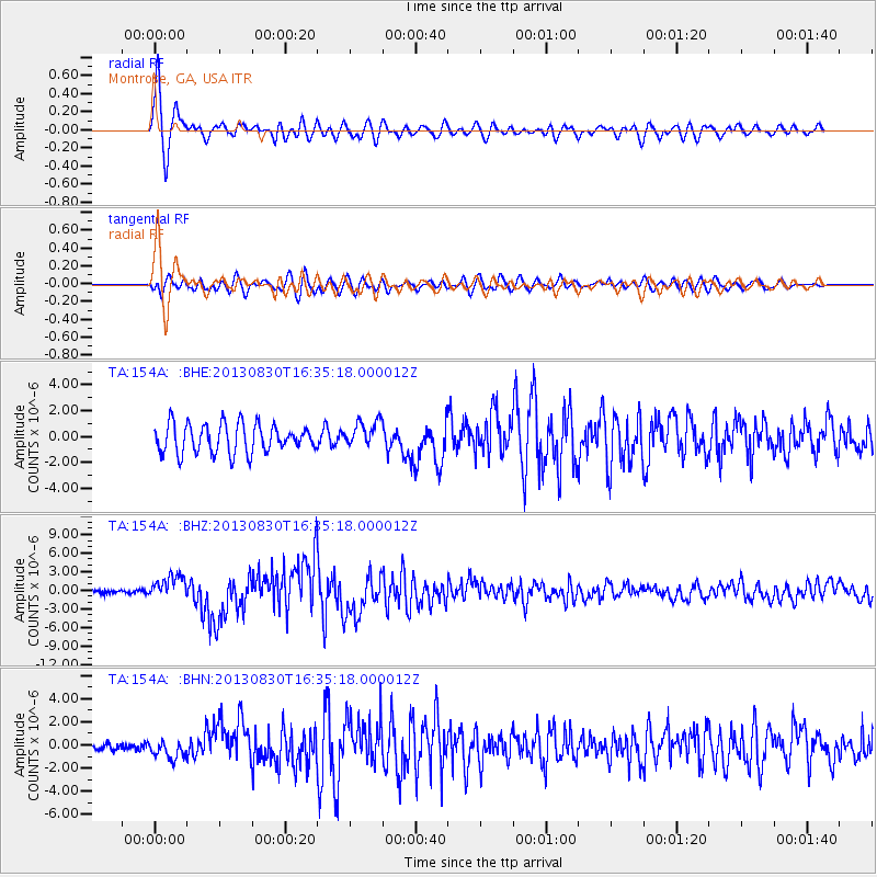
Signal To Noise
| Channel | StoN | STA | LTA |
| TA:154A: :BHZ:20130830T16:35:18.000012Z | 7.164246 | 1.9427976E-6 | 2.7117963E-7 |
| TA:154A: :BHN:20130830T16:35:18.000012Z | 2.1886435 | 8.260608E-7 | 3.774305E-7 |
| TA:154A: :BHE:20130830T16:35:18.000012Z | 0.92118686 | 1.0224267E-6 | 1.1099014E-6 |
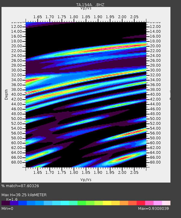
| Arrivals | |
| Ps | 3.8 SECOND |
| PpPs | 15 SECOND |
| PsPs/PpSs | 19 SECOND |

