
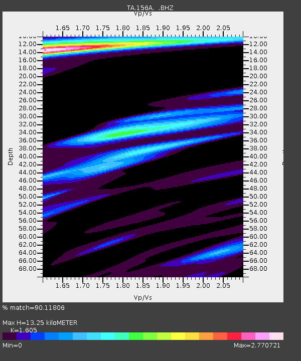
156A Sylvania, GA, USA - Earthquake Result Viewer
| ||||||||||||||||||
| ||||||||||||||||||
| ||||||||||||||||||
|
Signal To Noise
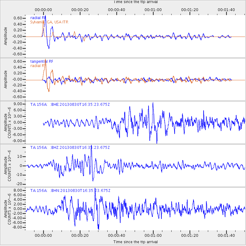
| Channel | StoN | STA | LTA |
| TA:156A: :BHZ:20130830T16:35:23.675Z | 2.3116302 | 2.147134E-6 | 9.288397E-7 |
| TA:156A: :BHN:20130830T16:35:23.675Z | 1.3612978 | 1.1637409E-6 | 8.54876E-7 |
| TA:156A: :BHE:20130830T16:35:23.675Z | 1.4871696 | 1.5094523E-6 | 1.0149832E-6 |
| Arrivals | |
| Ps | 1.3 SECOND |
| PpPs | 5.0 SECOND |
| PsPs/PpSs | 6.3 SECOND |

