435B Jarrell, TX, USA - Earthquake Result Viewer
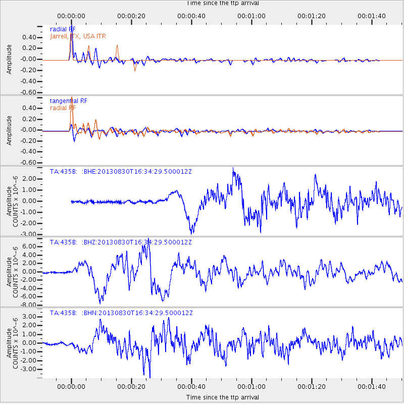
Earthquake location: Andreanof Islands, Aleutian Is.
Earthquake latitude/longitude: 51.5/-175.2
Earthquake time(UTC): 2013/08/30 (242) 16:25:02 GMT
Earthquake Depth: 29 km
Earthquake Magnitude: 7.0 MWW, 6.5 ML, 6.8 MI, 6.9 MWC, 6.9 MWB, 7.0 MWW, 7.0 MI, 7.0 MWC
Earthquake Catalog/Contributor: NEIC PDE/NEIC COMCAT
Network: TA USArray Transportable Network (new EarthScope stations)
Station: 435B Jarrell, TX, USA
Lat/Lon: 30.78 N/97.58 W
Elevation: 248 m
Distance: 59.2 deg
Az: 78.29 deg
Baz: 314.715 deg
Ray Param: 0.062328752
Estimated Moho Depth: 15.0 km
Estimated Crust Vp/Vs: 1.60
Assumed Crust Vp: 6.347 km/s
Estimated Crust Vs: 3.967 km/s
Estimated Crust Poisson's Ratio: 0.18
Radial Match: 97.60661 %
Radial Bump: 400
Transverse Match: 87.30971 %
Transverse Bump: 400
SOD ConfigId: 626651
Insert Time: 2014-04-18 05:16:02.637 +0000
GWidth: 2.5
Max Bumps: 400
Tol: 0.001

Signal To Noise

ChannelStoNSTALTA
TA:435B: :BHZ:20130830T16:34:29.500012Z15.2576341.5356047E-61.00645E-7
TA:435B: :BHN:20130830T16:34:29.500012Z7.5185125.322272E-77.07889E-8
TA:435B: :BHE:20130830T16:34:29.500012Z7.71419955.372152E-76.963979E-8
Arrivals
Ps1.5 SECOND
PpPs5.8 SECOND
PsPs/PpSs7.3 SECOND