656A Willston, FL, USA - Earthquake Result Viewer
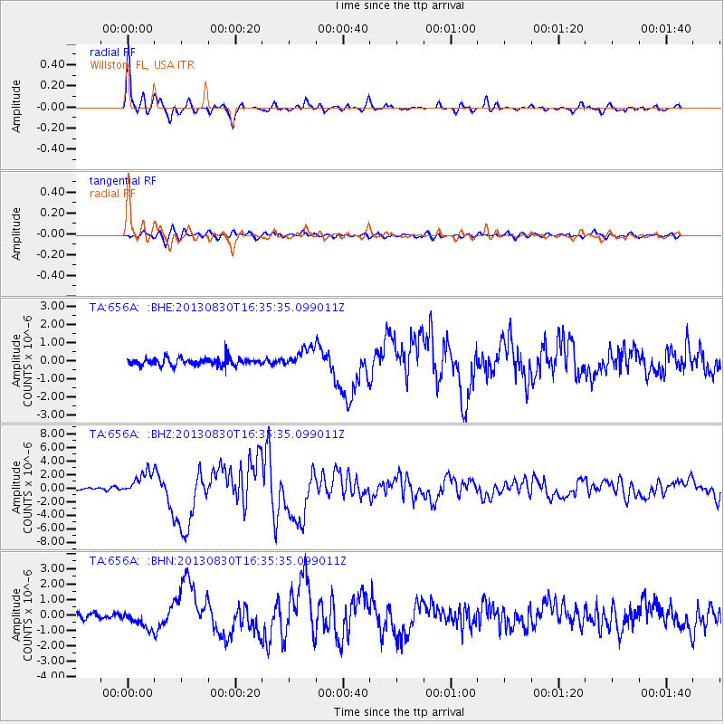
Earthquake location: Andreanof Islands, Aleutian Is.
Earthquake latitude/longitude: 51.5/-175.2
Earthquake time(UTC): 2013/08/30 (242) 16:25:02 GMT
Earthquake Depth: 29 km
Earthquake Magnitude: 7.0 MWW, 6.5 ML, 6.8 MI, 6.9 MWC, 6.9 MWB, 7.0 MWW, 7.0 MI, 7.0 MWC
Earthquake Catalog/Contributor: NEIC PDE/NEIC COMCAT
Network: TA USArray Transportable Network (new EarthScope stations)
Station: 656A Willston, FL, USA
Lat/Lon: 29.37 N/82.53 W
Elevation: 28 m
Distance: 69.2 deg
Az: 68.88 deg
Baz: 318.129 deg
Ray Param: 0.05577675
Estimated Moho Depth: 29.5 km
Estimated Crust Vp/Vs: 2.03
Assumed Crust Vp: 5.989 km/s
Estimated Crust Vs: 2.954 km/s
Estimated Crust Poisson's Ratio: 0.34
Radial Match: 96.8764 %
Radial Bump: 346
Transverse Match: 81.1363 %
Transverse Bump: 400
SOD ConfigId: 626651
Insert Time: 2014-04-18 05:16:23.301 +0000
GWidth: 2.5
Max Bumps: 400
Tol: 0.001

Signal To Noise

ChannelStoNSTALTA
TA:656A: :BHZ:20130830T16:35:35.099011Z9.55392551.7324237E-61.8133109E-7
TA:656A: :BHN:20130830T16:35:35.099011Z2.21268065.915183E-72.6733107E-7
TA:656A: :BHE:20130830T16:35:35.099011Z2.57832365.4714195E-72.1220842E-7
Arrivals
Ps5.2 SECOND
PpPs14 SECOND
PsPs/PpSs20 SECOND