A04D Lummi Island, WA, USA - Earthquake Result Viewer
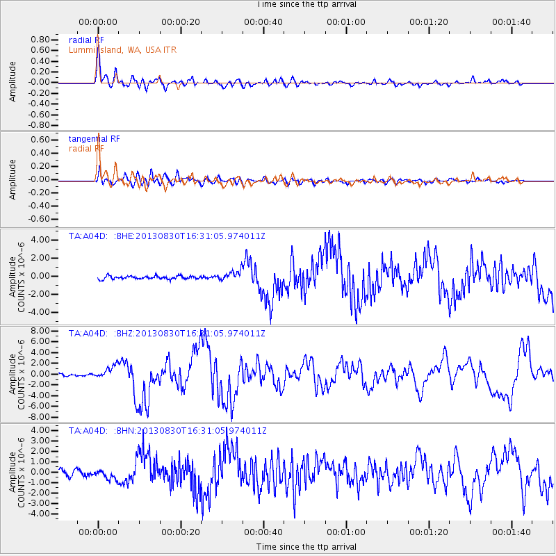
Earthquake location: Andreanof Islands, Aleutian Is.
Earthquake latitude/longitude: 51.5/-175.2
Earthquake time(UTC): 2013/08/30 (242) 16:25:02 GMT
Earthquake Depth: 29 km
Earthquake Magnitude: 7.0 MWW, 6.5 ML, 6.8 MI, 6.9 MWC, 6.9 MWB, 7.0 MWW, 7.0 MI, 7.0 MWC
Earthquake Catalog/Contributor: NEIC PDE/NEIC COMCAT
Network: TA USArray Transportable Network (new EarthScope stations)
Station: A04D Lummi Island, WA, USA
Lat/Lon: 48.72 N/122.71 W
Elevation: 13 m
Distance: 33.2 deg
Az: 73.737 deg
Baz: 295.125 deg
Ray Param: 0.078277014
Estimated Moho Depth: 52.5 km
Estimated Crust Vp/Vs: 1.97
Assumed Crust Vp: 6.566 km/s
Estimated Crust Vs: 3.329 km/s
Estimated Crust Poisson's Ratio: 0.33
Radial Match: 91.52406 %
Radial Bump: 400
Transverse Match: 78.73838 %
Transverse Bump: 400
SOD ConfigId: 626651
Insert Time: 2014-04-18 05:16:37.478 +0000
GWidth: 2.5
Max Bumps: 400
Tol: 0.001

Signal To Noise

ChannelStoNSTALTA
TA:A04D: :BHZ:20130830T16:31:05.974011Z8.0125281.2881721E-61.6076974E-7
TA:A04D: :BHN:20130830T16:31:05.974011Z1.3834064.4889913E-73.2448835E-7
TA:A04D: :BHE:20130830T16:31:05.974011Z3.29099235.5645734E-71.6908497E-7
Arrivals
Ps8.4 SECOND
PpPs22 SECOND
PsPs/PpSs30 SECOND