BGNE Belgrade, NE, USA - Earthquake Result Viewer
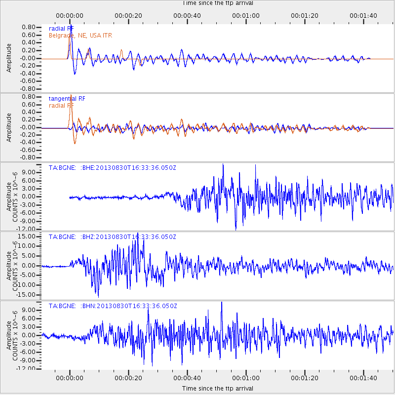
Earthquake location: Andreanof Islands, Aleutian Is.
Earthquake latitude/longitude: 51.5/-175.2
Earthquake time(UTC): 2013/08/30 (242) 16:25:02 GMT
Earthquake Depth: 29 km
Earthquake Magnitude: 7.0 MWW, 6.5 ML, 6.8 MI, 6.9 MWC, 6.9 MWB, 7.0 MWW, 7.0 MI, 7.0 MWC
Earthquake Catalog/Contributor: NEIC PDE/NEIC COMCAT
Network: TA USArray Transportable Network (new EarthScope stations)
Station: BGNE Belgrade, NE, USA
Lat/Lon: 41.41 N/98.15 W
Elevation: 573 m
Distance: 51.7 deg
Az: 69.085 deg
Baz: 309.14 deg
Ray Param: 0.06718406
Estimated Moho Depth: 33.25 km
Estimated Crust Vp/Vs: 1.60
Assumed Crust Vp: 6.53 km/s
Estimated Crust Vs: 4.082 km/s
Estimated Crust Poisson's Ratio: 0.18
Radial Match: 94.69585 %
Radial Bump: 400
Transverse Match: 79.92973 %
Transverse Bump: 400
SOD ConfigId: 626651
Insert Time: 2014-04-18 05:16:42.689 +0000
GWidth: 2.5
Max Bumps: 400
Tol: 0.001

Signal To Noise

ChannelStoNSTALTA
TA:BGNE: :BHZ:20130830T16:33:36.050Z15.0684692.2747245E-61.5095922E-7
TA:BGNE: :BHN:20130830T16:33:36.050Z1.62114487.152847E-74.41222E-7
TA:BGNE: :BHE:20130830T16:33:36.050Z3.84962279.583234E-72.4893956E-7
Arrivals
Ps3.3 SECOND
PpPs12 SECOND
PsPs/PpSs16 SECOND