D41A Chassel, MI, USA - Earthquake Result Viewer
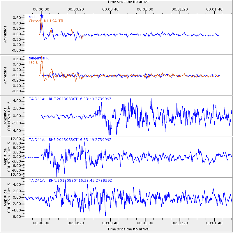
Earthquake location: Andreanof Islands, Aleutian Is.
Earthquake latitude/longitude: 51.5/-175.2
Earthquake time(UTC): 2013/08/30 (242) 16:25:02 GMT
Earthquake Depth: 29 km
Earthquake Magnitude: 7.0 MWW, 6.5 ML, 6.8 MI, 6.9 MWC, 6.9 MWB, 7.0 MWW, 7.0 MI, 7.0 MWC
Earthquake Catalog/Contributor: NEIC PDE/NEIC COMCAT
Network: TA USArray Transportable Network (new EarthScope stations)
Station: D41A Chassel, MI, USA
Lat/Lon: 47.06 N/88.57 W
Elevation: 271 m
Distance: 53.5 deg
Az: 58.106 deg
Baz: 309.138 deg
Ray Param: 0.0660057
Estimated Moho Depth: 43.75 km
Estimated Crust Vp/Vs: 1.86
Assumed Crust Vp: 6.467 km/s
Estimated Crust Vs: 3.481 km/s
Estimated Crust Poisson's Ratio: 0.30
Radial Match: 94.50419 %
Radial Bump: 400
Transverse Match: 78.189865 %
Transverse Bump: 400
SOD ConfigId: 626651
Insert Time: 2014-04-18 05:16:56.135 +0000
GWidth: 2.5
Max Bumps: 400
Tol: 0.001

Signal To Noise

ChannelStoNSTALTA
TA:D41A: :BHZ:20130830T16:33:49.273999Z17.0971133.512949E-62.0547031E-7
TA:D41A: :BHN:20130830T16:33:49.273999Z3.87591981.1150042E-62.8767474E-7
TA:D41A: :BHE:20130830T16:33:49.273999Z4.1356851.3124808E-63.173551E-7
Arrivals
Ps6.1 SECOND
PpPs18 SECOND
PsPs/PpSs24 SECOND