D49A Beulah Township, ON, CAN - Earthquake Result Viewer
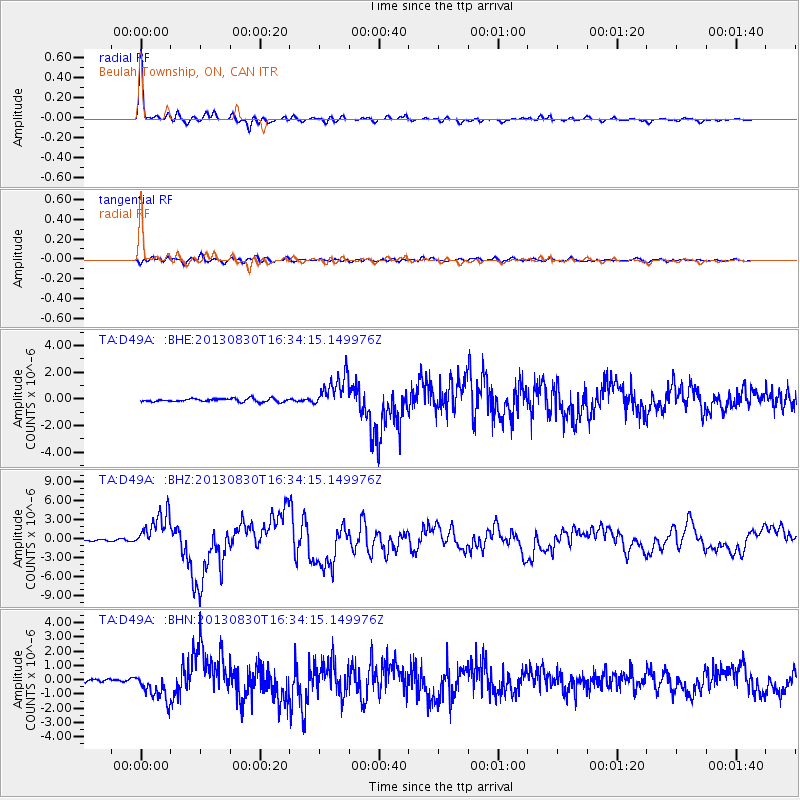
Earthquake location: Andreanof Islands, Aleutian Is.
Earthquake latitude/longitude: 51.5/-175.2
Earthquake time(UTC): 2013/08/30 (242) 16:25:02 GMT
Earthquake Depth: 29 km
Earthquake Magnitude: 7.0 MWW, 6.5 ML, 6.8 MI, 6.9 MWC, 6.9 MWB, 7.0 MWW, 7.0 MI, 7.0 MWC
Earthquake Catalog/Contributor: NEIC PDE/NEIC COMCAT
Network: TA USArray Transportable Network (new EarthScope stations)
Station: D49A Beulah Township, ON, CAN
Lat/Lon: 47.27 N/81.36 W
Elevation: 416 m
Distance: 57.1 deg
Az: 54.017 deg
Baz: 312.083 deg
Ray Param: 0.06366007
Estimated Moho Depth: 38.25 km
Estimated Crust Vp/Vs: 1.74
Assumed Crust Vp: 6.467 km/s
Estimated Crust Vs: 3.727 km/s
Estimated Crust Poisson's Ratio: 0.25
Radial Match: 96.67049 %
Radial Bump: 345
Transverse Match: 63.910645 %
Transverse Bump: 400
SOD ConfigId: 626651
Insert Time: 2014-04-18 05:17:04.958 +0000
GWidth: 2.5
Max Bumps: 400
Tol: 0.001

Signal To Noise

ChannelStoNSTALTA
TA:D49A: :BHZ:20130830T16:34:15.149976Z21.4864832.96543E-61.3801375E-7
TA:D49A: :BHN:20130830T16:34:15.149976Z5.1852499.978762E-71.924452E-7
TA:D49A: :BHE:20130830T16:34:15.149976Z10.3090241.2526395E-61.2150903E-7
Arrivals
Ps4.6 SECOND
PpPs15 SECOND
PsPs/PpSs20 SECOND