E38A The Farm, Brule, WI, USA - Earthquake Result Viewer
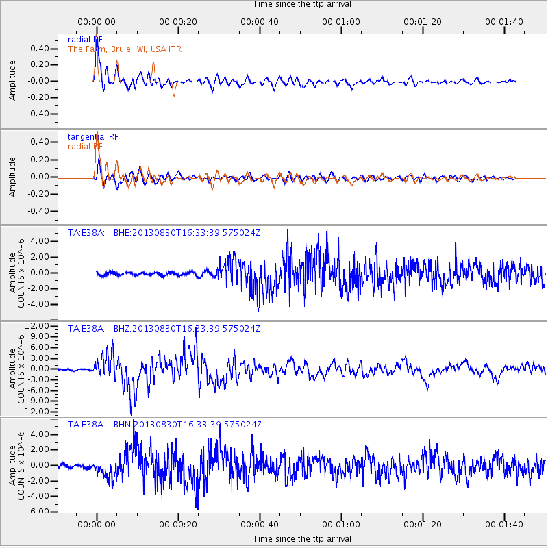
Earthquake location: Andreanof Islands, Aleutian Is.
Earthquake latitude/longitude: 51.5/-175.2
Earthquake time(UTC): 2013/08/30 (242) 16:25:02 GMT
Earthquake Depth: 29 km
Earthquake Magnitude: 7.0 MWW, 6.5 ML, 6.8 MI, 6.9 MWC, 6.9 MWB, 7.0 MWW, 7.0 MI, 7.0 MWC
Earthquake Catalog/Contributor: NEIC PDE/NEIC COMCAT
Network: TA USArray Transportable Network (new EarthScope stations)
Station: E38A The Farm, Brule, WI, USA
Lat/Lon: 46.61 N/91.55 W
Elevation: 341 m
Distance: 52.2 deg
Az: 60.16 deg
Baz: 308.206 deg
Ray Param: 0.06687204
Estimated Moho Depth: 67.75 km
Estimated Crust Vp/Vs: 1.99
Assumed Crust Vp: 6.467 km/s
Estimated Crust Vs: 3.25 km/s
Estimated Crust Poisson's Ratio: 0.33
Radial Match: 96.30334 %
Radial Bump: 400
Transverse Match: 89.11927 %
Transverse Bump: 400
SOD ConfigId: 626651
Insert Time: 2014-04-18 05:17:34.869 +0000
GWidth: 2.5
Max Bumps: 400
Tol: 0.001

Signal To Noise

ChannelStoNSTALTA
TA:E38A: :BHZ:20130830T16:33:39.575024Z17.2462793.3475478E-61.9410263E-7
TA:E38A: :BHN:20130830T16:33:39.575024Z4.85241371.1313128E-62.3314435E-7
TA:E38A: :BHE:20130830T16:33:39.575024Z7.46104761.4008784E-61.8775894E-7
Arrivals
Ps11 SECOND
PpPs30 SECOND
PsPs/PpSs41 SECOND