
E46A Sault Ste Marie, MI, USA - Earthquake Result Viewer
| ||||||||||||||||||
| ||||||||||||||||||
| ||||||||||||||||||
|
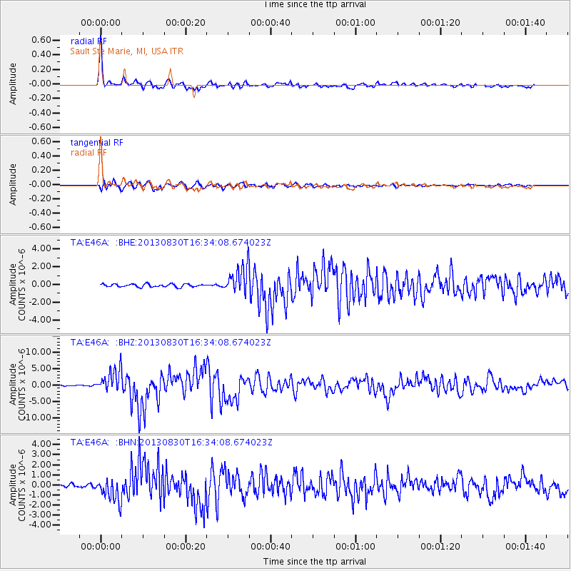
Signal To Noise
| Channel | StoN | STA | LTA |
| TA:E46A: :BHZ:20130830T16:34:08.674023Z | 20.741423 | 3.6021056E-6 | 1.7366723E-7 |
| TA:E46A: :BHN:20130830T16:34:08.674023Z | 10.197919 | 1.1885371E-6 | 1.1654702E-7 |
| TA:E46A: :BHE:20130830T16:34:08.674023Z | 9.641633 | 1.5841202E-6 | 1.6429999E-7 |
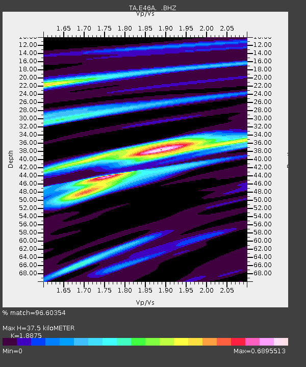
| Arrivals | |
| Ps | 5.4 SECOND |
| PpPs | 16 SECOND |
| PsPs/PpSs | 21 SECOND |

