E48A Lockeyer, ON, CAN - Earthquake Result Viewer
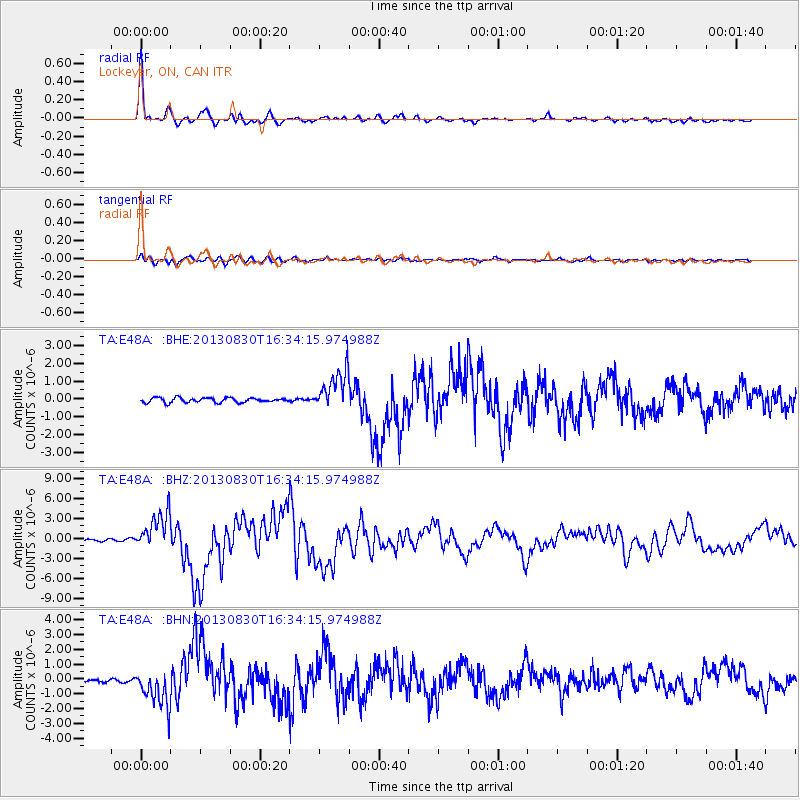
Earthquake location: Andreanof Islands, Aleutian Is.
Earthquake latitude/longitude: 51.5/-175.2
Earthquake time(UTC): 2013/08/30 (242) 16:25:02 GMT
Earthquake Depth: 29 km
Earthquake Magnitude: 7.0 MWW, 6.5 ML, 6.8 MI, 6.9 MWC, 6.9 MWB, 7.0 MWW, 7.0 MI, 7.0 MWC
Earthquake Catalog/Contributor: NEIC PDE/NEIC COMCAT
Network: TA USArray Transportable Network (new EarthScope stations)
Station: E48A Lockeyer, ON, CAN
Lat/Lon: 46.48 N/82.17 W
Elevation: 347 m
Distance: 57.2 deg
Az: 55.16 deg
Baz: 312.114 deg
Ray Param: 0.063584074
Estimated Moho Depth: 36.75 km
Estimated Crust Vp/Vs: 1.84
Assumed Crust Vp: 6.467 km/s
Estimated Crust Vs: 3.524 km/s
Estimated Crust Poisson's Ratio: 0.29
Radial Match: 97.36793 %
Radial Bump: 351
Transverse Match: 83.17998 %
Transverse Bump: 400
SOD ConfigId: 626651
Insert Time: 2014-04-18 05:17:48.307 +0000
GWidth: 2.5
Max Bumps: 400
Tol: 0.001

Signal To Noise

ChannelStoNSTALTA
TA:E48A: :BHZ:20130830T16:34:15.974988Z14.8794412.8478055E-61.9139198E-7
TA:E48A: :BHN:20130830T16:34:15.974988Z7.56262871.252015E-61.6555288E-7
TA:E48A: :BHE:20130830T16:34:15.974988Z8.5287021.1218541E-61.3153867E-7
Arrivals
Ps5.0 SECOND
PpPs15 SECOND
PsPs/PpSs20 SECOND