
E54A Lac Daplat, Pontiac, MRC, QC, CAN - Earthquake Result Viewer
| ||||||||||||||||||
| ||||||||||||||||||
| ||||||||||||||||||
|
Signal To Noise
| Channel | StoN | STA | LTA |
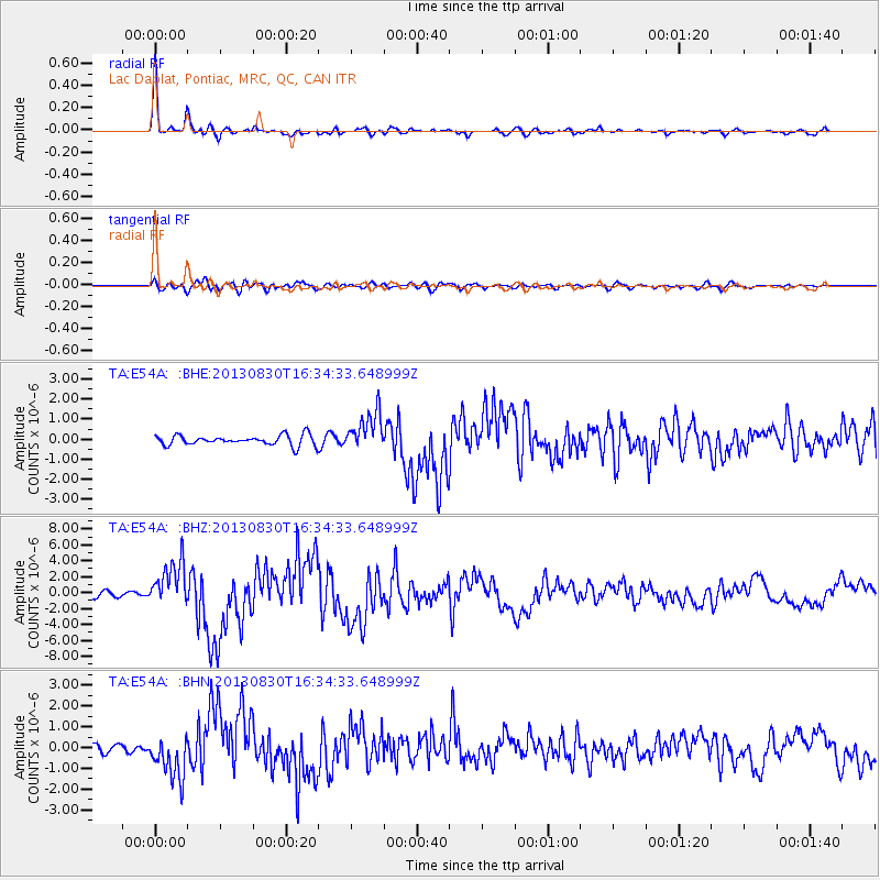
| TA:E54A: :BHZ:20130830T16:34:33.648999Z | 9.183507 | 2.8049767E-6 | 3.0543634E-7 |
| TA:E54A: :BHN:20130830T16:34:33.648999Z | 6.65075 | 1.0524928E-6 | 1.5825174E-7 |
| TA:E54A: :BHE:20130830T16:34:33.648999Z | 3.8450835 | 9.605607E-7 | 2.4981532E-7 |
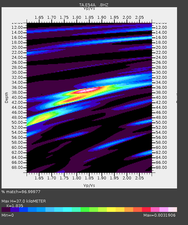
| Arrivals | |
| Ps | 4.9 SECOND |
| PpPs | 15 SECOND |
| PsPs/PpSs | 20 SECOND |

