F42A Maple Grove Farm, Niagara, WI, USA - Earthquake Result Viewer
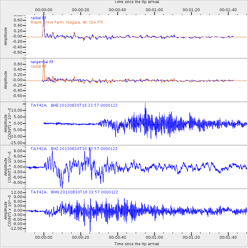
Earthquake location: Andreanof Islands, Aleutian Is.
Earthquake latitude/longitude: 51.5/-175.2
Earthquake time(UTC): 2013/08/30 (242) 16:25:02 GMT
Earthquake Depth: 29 km
Earthquake Magnitude: 7.0 MWW, 6.5 ML, 6.8 MI, 6.9 MWC, 6.9 MWB, 7.0 MWW, 7.0 MI, 7.0 MWC
Earthquake Catalog/Contributor: NEIC PDE/NEIC COMCAT
Network: TA USArray Transportable Network (new EarthScope stations)
Station: F42A Maple Grove Farm, Niagara, WI, USA
Lat/Lon: 45.76 N/88.13 W
Elevation: 358 m
Distance: 54.6 deg
Az: 59.111 deg
Baz: 310.04 deg
Ray Param: 0.065323465
Estimated Moho Depth: 41.5 km
Estimated Crust Vp/Vs: 1.75
Assumed Crust Vp: 6.41 km/s
Estimated Crust Vs: 3.674 km/s
Estimated Crust Poisson's Ratio: 0.26
Radial Match: 95.95166 %
Radial Bump: 400
Transverse Match: 77.19665 %
Transverse Bump: 400
SOD ConfigId: 626651
Insert Time: 2014-04-18 05:18:19.078 +0000
GWidth: 2.5
Max Bumps: 400
Tol: 0.001

Signal To Noise

ChannelStoNSTALTA
TA:F42A: :BHZ:20130830T16:33:57.000012Z18.4111713.3321398E-61.8098469E-7
TA:F42A: :BHN:20130830T16:33:57.000012Z5.46866371.5266064E-62.7915527E-7
TA:F42A: :BHE:20130830T16:33:57.000012Z4.68559361.6528702E-63.5275573E-7
Arrivals
Ps5.1 SECOND
PpPs17 SECOND
PsPs/PpSs22 SECOND