F49A Sandfield, ON, CAN - Earthquake Result Viewer
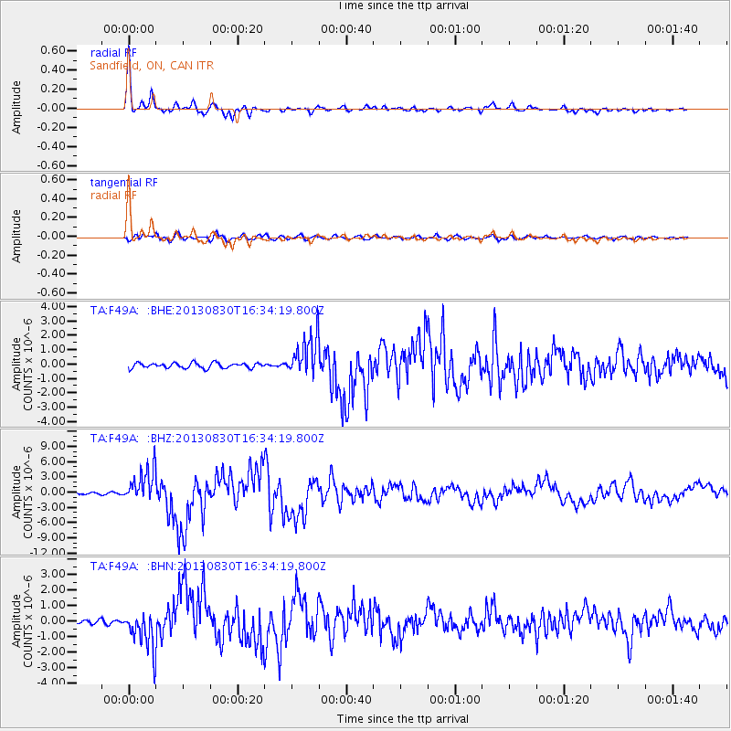
Earthquake location: Andreanof Islands, Aleutian Is.
Earthquake latitude/longitude: 51.5/-175.2
Earthquake time(UTC): 2013/08/30 (242) 16:25:02 GMT
Earthquake Depth: 29 km
Earthquake Magnitude: 7.0 MWW, 6.5 ML, 6.8 MI, 6.9 MWC, 6.9 MWB, 7.0 MWW, 7.0 MI, 7.0 MWC
Earthquake Catalog/Contributor: NEIC PDE/NEIC COMCAT
Network: TA USArray Transportable Network (new EarthScope stations)
Station: F49A Sandfield, ON, CAN
Lat/Lon: 45.76 N/82.04 W
Elevation: 230 m
Distance: 57.8 deg
Az: 55.721 deg
Baz: 312.504 deg
Ray Param: 0.06323573
Estimated Moho Depth: 39.5 km
Estimated Crust Vp/Vs: 1.63
Assumed Crust Vp: 6.483 km/s
Estimated Crust Vs: 3.983 km/s
Estimated Crust Poisson's Ratio: 0.20
Radial Match: 97.13852 %
Radial Bump: 328
Transverse Match: 79.68303 %
Transverse Bump: 400
SOD ConfigId: 626651
Insert Time: 2014-04-18 05:18:25.895 +0000
GWidth: 2.5
Max Bumps: 400
Tol: 0.001

Signal To Noise

ChannelStoNSTALTA
TA:F49A: :BHZ:20130830T16:34:19.800Z14.1627413.3816852E-62.3877337E-7
TA:F49A: :BHN:20130830T16:34:19.800Z5.52952431.2614242E-62.2812526E-7
TA:F49A: :BHE:20130830T16:34:19.800Z7.73049071.40527E-61.8178277E-7
Arrivals
Ps4.0 SECOND
PpPs15 SECOND
PsPs/PpSs19 SECOND