G60A Masonville, QC, CAN - Earthquake Result Viewer
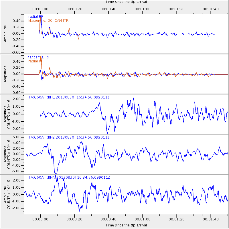
Earthquake location: Andreanof Islands, Aleutian Is.
Earthquake latitude/longitude: 51.5/-175.2
Earthquake time(UTC): 2013/08/30 (242) 16:25:02 GMT
Earthquake Depth: 29 km
Earthquake Magnitude: 7.0 MWW, 6.5 ML, 6.8 MI, 6.9 MWC, 6.9 MWB, 7.0 MWW, 7.0 MI, 7.0 MWC
Earthquake Catalog/Contributor: NEIC PDE/NEIC COMCAT
Network: TA USArray Transportable Network (new EarthScope stations)
Station: G60A Masonville, QC, CAN
Lat/Lon: 45.10 N/72.33 W
Elevation: 391 m
Distance: 63.1 deg
Az: 50.737 deg
Baz: 316.942 deg
Ray Param: 0.059758283
Estimated Moho Depth: 53.0 km
Estimated Crust Vp/Vs: 1.63
Assumed Crust Vp: 6.419 km/s
Estimated Crust Vs: 3.938 km/s
Estimated Crust Poisson's Ratio: 0.20
Radial Match: 95.25757 %
Radial Bump: 400
Transverse Match: 61.055508 %
Transverse Bump: 400
SOD ConfigId: 626651
Insert Time: 2014-04-18 05:19:15.283 +0000
GWidth: 2.5
Max Bumps: 400
Tol: 0.001

Signal To Noise

ChannelStoNSTALTA
TA:G60A: :BHZ:20130830T16:34:56.099011Z9.4463372.184253E-62.3122752E-7
TA:G60A: :BHN:20130830T16:34:56.099011Z2.73762258.718501E-73.184698E-7
TA:G60A: :BHE:20130830T16:34:56.099011Z3.8835028.350149E-72.1501596E-7
Arrivals
Ps5.5 SECOND
PpPs21 SECOND
PsPs/PpSs26 SECOND