
I42A Draeger Farm, Ripon, WI, USA - Earthquake Result Viewer
| ||||||||||||||||||
| ||||||||||||||||||
| ||||||||||||||||||
|
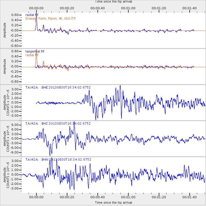
Signal To Noise
| Channel | StoN | STA | LTA |
| TA:I42A: :BHZ:20130830T16:34:02.675Z | 17.044481 | 2.9843297E-6 | 1.7509068E-7 |
| TA:I42A: :BHN:20130830T16:34:02.675Z | 6.9384146 | 1.0299362E-6 | 1.4843971E-7 |
| TA:I42A: :BHE:20130830T16:34:02.675Z | 11.969986 | 1.226682E-6 | 1.02479824E-7 |
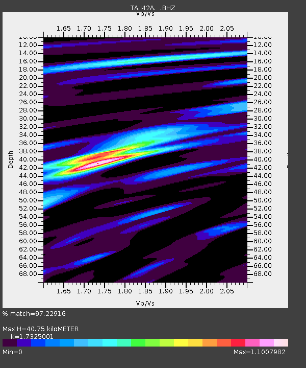
| Arrivals | |
| Ps | 4.8 SECOND |
| PpPs | 16 SECOND |
| PsPs/PpSs | 21 SECOND |

