
I55A Frankford, ON, CAN - Earthquake Result Viewer
| ||||||||||||||||||
| ||||||||||||||||||
| ||||||||||||||||||
|
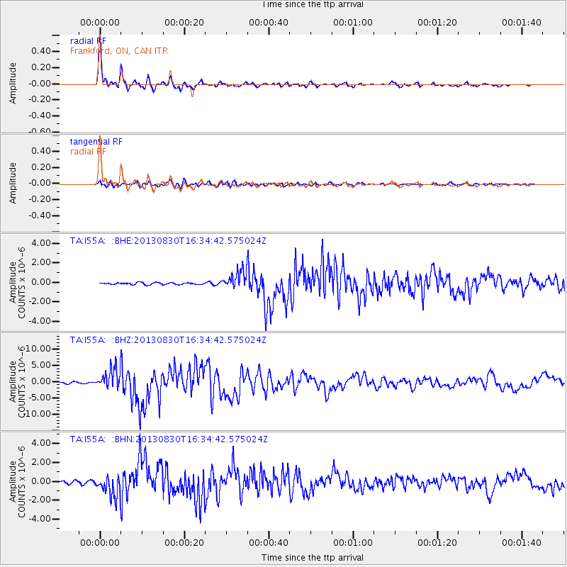
Signal To Noise
| Channel | StoN | STA | LTA |
| TA:I55A: :BHZ:20130830T16:34:42.575024Z | 16.919207 | 3.1548745E-6 | 1.8646705E-7 |
| TA:I55A: :BHN:20130830T16:34:42.575024Z | 6.108495 | 1.135848E-6 | 1.8594564E-7 |
| TA:I55A: :BHE:20130830T16:34:42.575024Z | 10.014959 | 9.404284E-7 | 9.3902365E-8 |
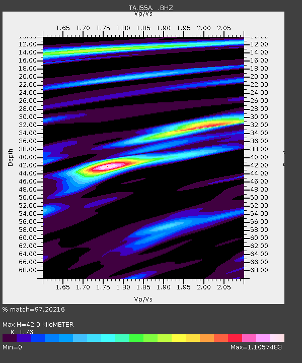
| Arrivals | |
| Ps | 5.1 SECOND |
| PpPs | 17 SECOND |
| PsPs/PpSs | 22 SECOND |

