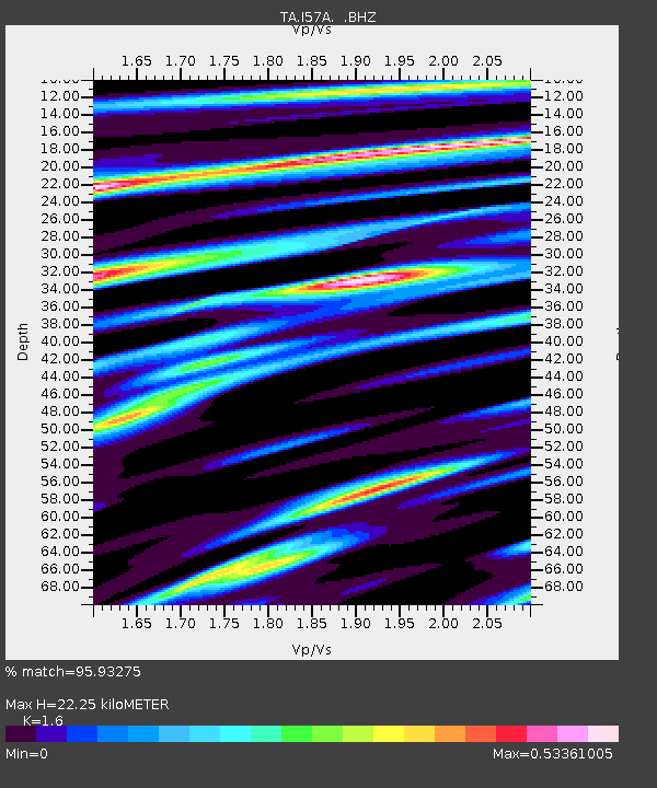
I57A Carthage, NY, USA - Earthquake Result Viewer

Earthquake location: Andreanof Islands, Aleutian Is.
Earthquake latitude/longitude: 51.5/-175.2
Earthquake time(UTC): 2013/08/30 (242) 16:25:02 GMT
Earthquake Depth: 29 km
Earthquake Magnitude: 7.0 MWW, 6.5 ML, 6.8 MI, 6.9 MWC, 6.9 MWB, 7.0 MWW, 7.0 MI, 7.0 MWC
Earthquake Catalog/Contributor: NEIC PDE/NEIC COMCAT
Network: TA USArray Transportable Network (new EarthScope stations)
Station: I57A Carthage, NY, USA
Lat/Lon: 43.94 N/75.66 W
Elevation: 321 m
Distance: 62.3 deg
Az: 53.576 deg
Baz: 315.92 deg
Ray Param: 0.06027873
Estimated Moho Depth: 22.25 km
Estimated Crust Vp/Vs: 1.60
Assumed Crust Vp: 6.419 km/s
Estimated Crust Vs: 4.012 km/s
Estimated Crust Poisson's Ratio: 0.18
Radial Match: 95.93275 %
Radial Bump: 380
Transverse Match: 76.70065 %
Transverse Bump: 400
SOD ConfigId: 626651
Insert Time: 2014-04-18 05:20:24.897 +0000
GWidth: 2.5
Max Bumps: 400
Tol: 0.001

Signal To Noise

ChannelStoNSTALTA
TA:I57A: :BHZ:20130830T16:34:50.774976Z9.5515312.8174632E-62.9497502E-7
TA:I57A: :BHN:20130830T16:34:50.774976Z3.6790911.085959E-62.9517048E-7
TA:I57A: :BHE:20130830T16:34:50.774976Z4.0934229.87691E-72.4128738E-7
Arrivals
Ps2.2 SECOND
PpPs8.6 SECOND
PsPs/PpSs11 SECOND