J45A Montague, MI, USA - Earthquake Result Viewer
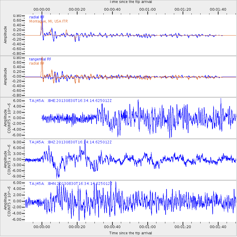
Earthquake location: Andreanof Islands, Aleutian Is.
Earthquake latitude/longitude: 51.5/-175.2
Earthquake time(UTC): 2013/08/30 (242) 16:25:02 GMT
Earthquake Depth: 29 km
Earthquake Magnitude: 7.0 MWW, 6.5 ML, 6.8 MI, 6.9 MWC, 6.9 MWB, 7.0 MWW, 7.0 MI, 7.0 MWC
Earthquake Catalog/Contributor: NEIC PDE/NEIC COMCAT
Network: TA USArray Transportable Network (new EarthScope stations)
Station: J45A Montague, MI, USA
Lat/Lon: 43.44 N/86.39 W
Elevation: 209 m
Distance: 57.0 deg
Az: 60.243 deg
Baz: 311.898 deg
Ray Param: 0.06370764
Estimated Moho Depth: 14.5 km
Estimated Crust Vp/Vs: 1.61
Assumed Crust Vp: 6.483 km/s
Estimated Crust Vs: 4.033 km/s
Estimated Crust Poisson's Ratio: 0.18
Radial Match: 90.83084 %
Radial Bump: 400
Transverse Match: 74.27813 %
Transverse Bump: 400
SOD ConfigId: 626651
Insert Time: 2014-04-18 05:20:35.894 +0000
GWidth: 2.5
Max Bumps: 400
Tol: 0.001

Signal To Noise

ChannelStoNSTALTA
TA:J45A: :BHZ:20130830T16:34:14.625012Z5.5104592.8857648E-65.236887E-7
TA:J45A: :BHN:20130830T16:34:14.625012Z2.26581431.5438965E-66.81387E-7
TA:J45A: :BHE:20130830T16:34:14.625012Z2.30963641.8950294E-68.2048825E-7
Arrivals
Ps1.4 SECOND
PpPs5.5 SECOND
PsPs/PpSs6.9 SECOND