J47A Sunmer, MI, USA - Earthquake Result Viewer
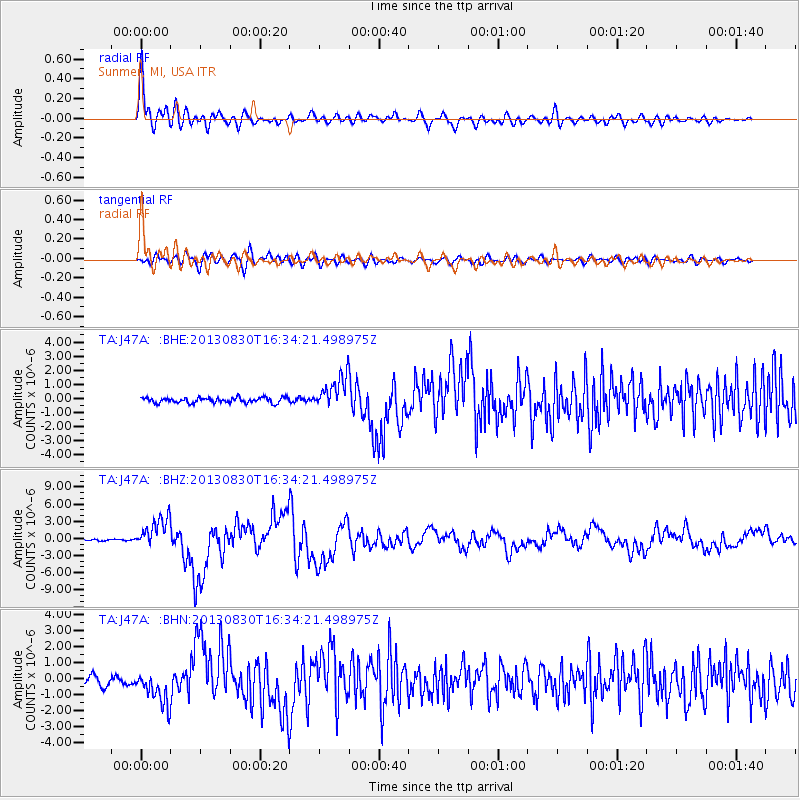
Earthquake location: Andreanof Islands, Aleutian Is.
Earthquake latitude/longitude: 51.5/-175.2
Earthquake time(UTC): 2013/08/30 (242) 16:25:02 GMT
Earthquake Depth: 29 km
Earthquake Magnitude: 7.0 MWW, 6.5 ML, 6.8 MI, 6.9 MWC, 6.9 MWB, 7.0 MWW, 7.0 MI, 7.0 MWC
Earthquake Catalog/Contributor: NEIC PDE/NEIC COMCAT
Network: TA USArray Transportable Network (new EarthScope stations)
Station: J47A Sunmer, MI, USA
Lat/Lon: 43.24 N/84.82 W
Elevation: 236 m
Distance: 58.0 deg
Az: 59.504 deg
Baz: 312.574 deg
Ray Param: 0.06307885
Estimated Moho Depth: 41.25 km
Estimated Crust Vp/Vs: 1.87
Assumed Crust Vp: 6.483 km/s
Estimated Crust Vs: 3.467 km/s
Estimated Crust Poisson's Ratio: 0.30
Radial Match: 93.61001 %
Radial Bump: 400
Transverse Match: 80.172905 %
Transverse Bump: 400
SOD ConfigId: 626651
Insert Time: 2014-04-18 05:20:40.636 +0000
GWidth: 2.5
Max Bumps: 400
Tol: 0.001

Signal To Noise

ChannelStoNSTALTA
TA:J47A: :BHZ:20130830T16:34:21.498975Z19.9665662.7225797E-61.3635695E-7
TA:J47A: :BHN:20130830T16:34:21.498975Z3.5109411.0260616E-62.9224688E-7
TA:J47A: :BHE:20130830T16:34:21.498975Z6.1942971.1544951E-61.8638032E-7
Arrivals
Ps5.8 SECOND
PpPs17 SECOND
PsPs/PpSs23 SECOND