J49A Marlette, MI, USA - Earthquake Result Viewer
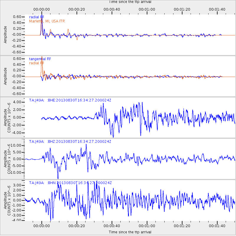
Earthquake location: Andreanof Islands, Aleutian Is.
Earthquake latitude/longitude: 51.5/-175.2
Earthquake time(UTC): 2013/08/30 (242) 16:25:02 GMT
Earthquake Depth: 29 km
Earthquake Magnitude: 7.0 MWW, 6.5 ML, 6.8 MI, 6.9 MWC, 6.9 MWB, 7.0 MWW, 7.0 MI, 7.0 MWC
Earthquake Catalog/Contributor: NEIC PDE/NEIC COMCAT
Network: TA USArray Transportable Network (new EarthScope stations)
Station: J49A Marlette, MI, USA
Lat/Lon: 43.36 N/83.14 W
Elevation: 253 m
Distance: 58.8 deg
Az: 58.419 deg
Baz: 313.155 deg
Ray Param: 0.06254635
Estimated Moho Depth: 16.0 km
Estimated Crust Vp/Vs: 1.63
Assumed Crust Vp: 6.483 km/s
Estimated Crust Vs: 3.971 km/s
Estimated Crust Poisson's Ratio: 0.20
Radial Match: 95.64949 %
Radial Bump: 382
Transverse Match: 79.72853 %
Transverse Bump: 400
SOD ConfigId: 626651
Insert Time: 2014-04-18 05:20:45.243 +0000
GWidth: 2.5
Max Bumps: 400
Tol: 0.001

Signal To Noise

ChannelStoNSTALTA
TA:J49A: :BHZ:20130830T16:34:27.200024Z13.5498653.0452866E-62.2474663E-7
TA:J49A: :BHN:20130830T16:34:27.200024Z3.67488229.563689E-72.602448E-7
TA:J49A: :BHE:20130830T16:34:27.200024Z4.4833241.0213286E-62.278061E-7
Arrivals
Ps1.6 SECOND
PpPs6.2 SECOND
PsPs/PpSs7.8 SECOND