
J54A Appleton, NY, USA - Earthquake Result Viewer
| ||||||||||||||||||
| ||||||||||||||||||
| ||||||||||||||||||
|
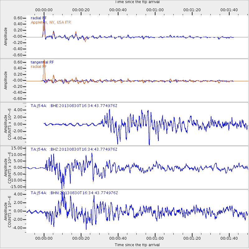
Signal To Noise
| Channel | StoN | STA | LTA |
| TA:J54A: :BHZ:20130830T16:34:43.774976Z | 11.0277195 | 3.30656E-6 | 2.998408E-7 |
| TA:J54A: :BHN:20130830T16:34:43.774976Z | 5.291978 | 9.4908864E-7 | 1.7934478E-7 |
| TA:J54A: :BHE:20130830T16:34:43.774976Z | 5.4529266 | 1.0394189E-6 | 1.9061669E-7 |
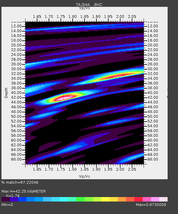
| Arrivals | |
| Ps | 5.2 SECOND |
| PpPs | 17 SECOND |
| PsPs/PpSs | 23 SECOND |

