L44A Lake County Forest Preserve, Grayslake, IL, USA - Earthquake Result Viewer
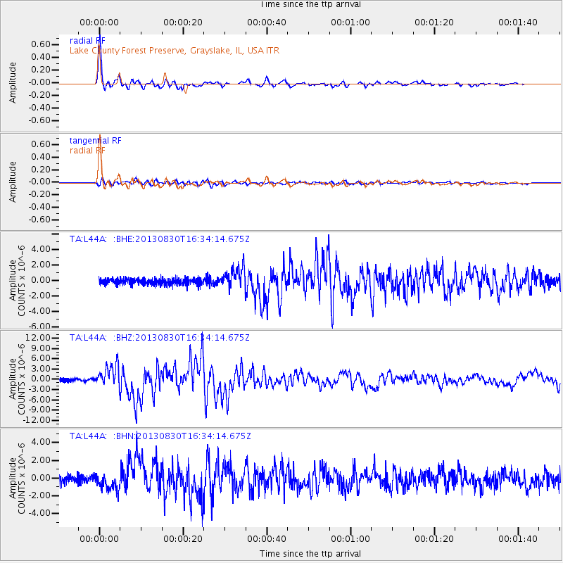
Earthquake location: Andreanof Islands, Aleutian Is.
Earthquake latitude/longitude: 51.5/-175.2
Earthquake time(UTC): 2013/08/30 (242) 16:25:02 GMT
Earthquake Depth: 29 km
Earthquake Magnitude: 7.0 MWW, 6.5 ML, 6.8 MI, 6.9 MWC, 6.9 MWB, 7.0 MWW, 7.0 MI, 7.0 MWC
Earthquake Catalog/Contributor: NEIC PDE/NEIC COMCAT
Network: TA USArray Transportable Network (new EarthScope stations)
Station: L44A Lake County Forest Preserve, Grayslake, IL, USA
Lat/Lon: 42.18 N/87.91 W
Elevation: 202 m
Distance: 57.0 deg
Az: 62.25 deg
Baz: 311.959 deg
Ray Param: 0.06370391
Estimated Moho Depth: 40.25 km
Estimated Crust Vp/Vs: 1.73
Assumed Crust Vp: 6.483 km/s
Estimated Crust Vs: 3.747 km/s
Estimated Crust Poisson's Ratio: 0.25
Radial Match: 97.76407 %
Radial Bump: 292
Transverse Match: 80.43754 %
Transverse Bump: 400
SOD ConfigId: 626651
Insert Time: 2014-04-18 05:21:59.357 +0000
GWidth: 2.5
Max Bumps: 400
Tol: 0.001

Signal To Noise

ChannelStoNSTALTA
TA:L44A: :BHZ:20130830T16:34:14.675Z7.67024473.157083E-64.1160135E-7
TA:L44A: :BHN:20130830T16:34:14.675Z1.98089498.302342E-74.1912077E-7
TA:L44A: :BHE:20130830T16:34:14.675Z3.55892591.3545466E-63.8060546E-7
Arrivals
Ps4.8 SECOND
PpPs16 SECOND
PsPs/PpSs21 SECOND