L49A Milan, MI, USA - Earthquake Result Viewer
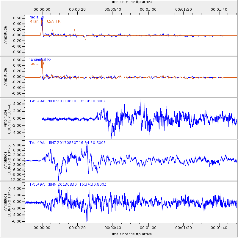
Earthquake location: Andreanof Islands, Aleutian Is.
Earthquake latitude/longitude: 51.5/-175.2
Earthquake time(UTC): 2013/08/30 (242) 16:25:02 GMT
Earthquake Depth: 29 km
Earthquake Magnitude: 7.0 MWW, 6.5 ML, 6.8 MI, 6.9 MWC, 6.9 MWB, 7.0 MWW, 7.0 MI, 7.0 MWC
Earthquake Catalog/Contributor: NEIC PDE/NEIC COMCAT
Network: TA USArray Transportable Network (new EarthScope stations)
Station: L49A Milan, MI, USA
Lat/Lon: 42.11 N/83.77 W
Elevation: 230 m
Distance: 59.3 deg
Az: 59.849 deg
Baz: 313.465 deg
Ray Param: 0.06220315
Estimated Moho Depth: 64.25 km
Estimated Crust Vp/Vs: 2.03
Assumed Crust Vp: 6.483 km/s
Estimated Crust Vs: 3.189 km/s
Estimated Crust Poisson's Ratio: 0.34
Radial Match: 97.89746 %
Radial Bump: 296
Transverse Match: 89.654 %
Transverse Bump: 400
SOD ConfigId: 626651
Insert Time: 2014-04-18 05:22:08.924 +0000
GWidth: 2.5
Max Bumps: 400
Tol: 0.001

Signal To Noise

ChannelStoNSTALTA
TA:L49A: :BHZ:20130830T16:34:30.800Z12.1808242.4871986E-62.0418967E-7
TA:L49A: :BHN:20130830T16:34:30.800Z4.34765059.0893406E-72.0906329E-7
TA:L49A: :BHE:20130830T16:34:30.800Z5.7717921.1343129E-61.96527E-7
Arrivals
Ps11 SECOND
PpPs29 SECOND
PsPs/PpSs39 SECOND