L50A Kingsville, ON, CAN - Earthquake Result Viewer
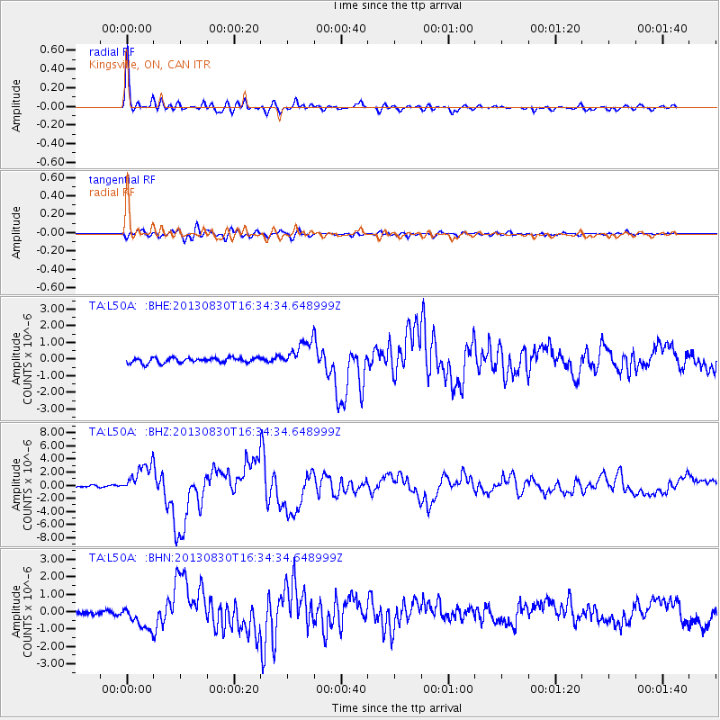
Earthquake location: Andreanof Islands, Aleutian Is.
Earthquake latitude/longitude: 51.5/-175.2
Earthquake time(UTC): 2013/08/30 (242) 16:25:02 GMT
Earthquake Depth: 29 km
Earthquake Magnitude: 7.0 MWW, 6.5 ML, 6.8 MI, 6.9 MWC, 6.9 MWB, 7.0 MWW, 7.0 MI, 7.0 MWC
Earthquake Catalog/Contributor: NEIC PDE/NEIC COMCAT
Network: TA USArray Transportable Network (new EarthScope stations)
Station: L50A Kingsville, ON, CAN
Lat/Lon: 42.04 N/82.81 W
Elevation: 187 m
Distance: 59.9 deg
Az: 59.334 deg
Baz: 313.844 deg
Ray Param: 0.061835486
Estimated Moho Depth: 55.25 km
Estimated Crust Vp/Vs: 1.73
Assumed Crust Vp: 6.483 km/s
Estimated Crust Vs: 3.742 km/s
Estimated Crust Poisson's Ratio: 0.25
Radial Match: 96.683815 %
Radial Bump: 364
Transverse Match: 85.36598 %
Transverse Bump: 400
SOD ConfigId: 626651
Insert Time: 2014-04-18 05:22:14.086 +0000
GWidth: 2.5
Max Bumps: 400
Tol: 0.001

Signal To Noise

ChannelStoNSTALTA
TA:L50A: :BHZ:20130830T16:34:34.648999Z13.4639032.3012572E-61.709205E-7
TA:L50A: :BHN:20130830T16:34:34.648999Z4.02177437.051494E-71.7533291E-7
TA:L50A: :BHE:20130830T16:34:34.648999Z5.21263658.0966106E-71.5532659E-7
Arrivals
Ps6.6 SECOND
PpPs22 SECOND
PsPs/PpSs29 SECOND