L54A Sinclairville, NY, USA - Earthquake Result Viewer
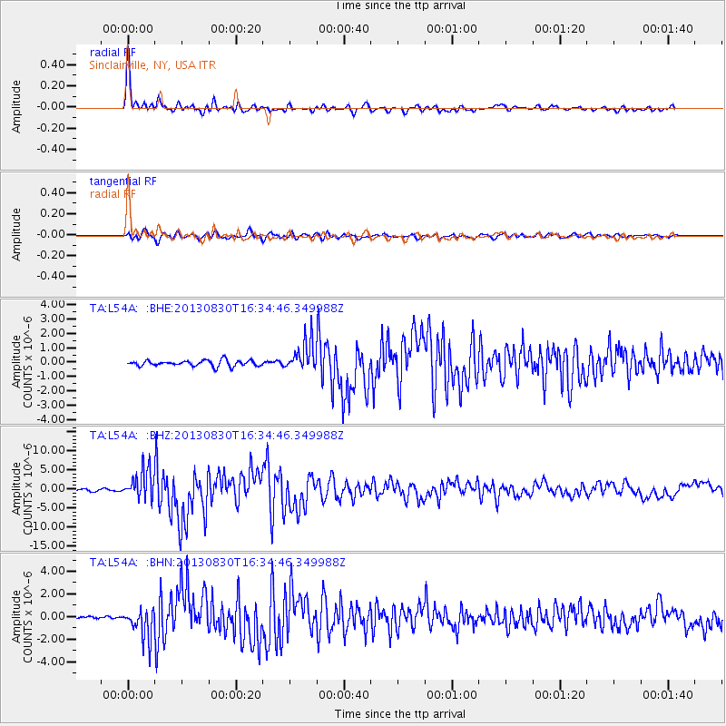
Earthquake location: Andreanof Islands, Aleutian Is.
Earthquake latitude/longitude: 51.5/-175.2
Earthquake time(UTC): 2013/08/30 (242) 16:25:02 GMT
Earthquake Depth: 29 km
Earthquake Magnitude: 7.0 MWW, 6.5 ML, 6.8 MI, 6.9 MWC, 6.9 MWB, 7.0 MWW, 7.0 MI, 7.0 MWC
Earthquake Catalog/Contributor: NEIC PDE/NEIC COMCAT
Network: TA USArray Transportable Network (new EarthScope stations)
Station: L54A Sinclairville, NY, USA
Lat/Lon: 42.23 N/79.32 W
Elevation: 432 m
Distance: 61.6 deg
Az: 57.092 deg
Baz: 315.084 deg
Ray Param: 0.060709994
Estimated Moho Depth: 35.75 km
Estimated Crust Vp/Vs: 1.98
Assumed Crust Vp: 6.419 km/s
Estimated Crust Vs: 3.238 km/s
Estimated Crust Poisson's Ratio: 0.33
Radial Match: 97.48778 %
Radial Bump: 348
Transverse Match: 87.13741 %
Transverse Bump: 400
SOD ConfigId: 626651
Insert Time: 2014-04-18 05:22:18.629 +0000
GWidth: 2.5
Max Bumps: 400
Tol: 0.001

Signal To Noise

ChannelStoNSTALTA
TA:L54A: :BHZ:20130830T16:34:46.349988Z20.3845273.891274E-61.908935E-7
TA:L54A: :BHN:20130830T16:34:46.349988Z12.7591231.3477032E-61.0562664E-7
TA:L54A: :BHE:20130830T16:34:46.349988Z5.37752441.0690795E-61.9880515E-7
Arrivals
Ps5.7 SECOND
PpPs16 SECOND
PsPs/PpSs22 SECOND