
M59A Waymart, PA, USA - Earthquake Result Viewer
| ||||||||||||||||||
| ||||||||||||||||||
| ||||||||||||||||||
|
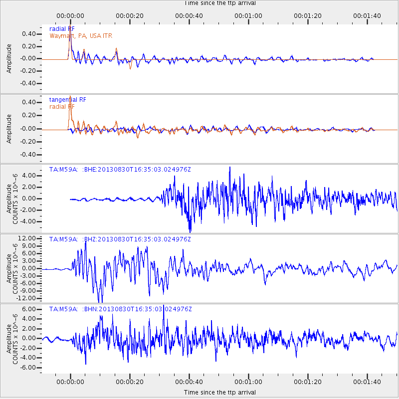
Signal To Noise
| Channel | StoN | STA | LTA |
| TA:M59A: :BHZ:20130830T16:35:03.024976Z | 17.537817 | 3.5002981E-6 | 1.9958574E-7 |
| TA:M59A: :BHN:20130830T16:35:03.024976Z | 4.605469 | 1.1618781E-6 | 2.5228223E-7 |
| TA:M59A: :BHE:20130830T16:35:03.024976Z | 8.005593 | 1.0886778E-6 | 1.3598964E-7 |
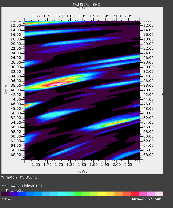
| Arrivals | |
| Ps | 4.6 SECOND |
| PpPs | 16 SECOND |
| PsPs/PpSs | 20 SECOND |

