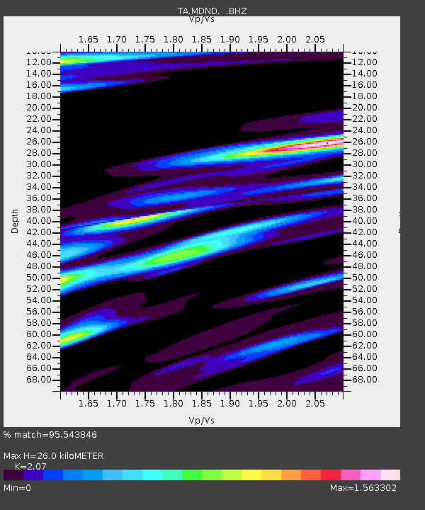
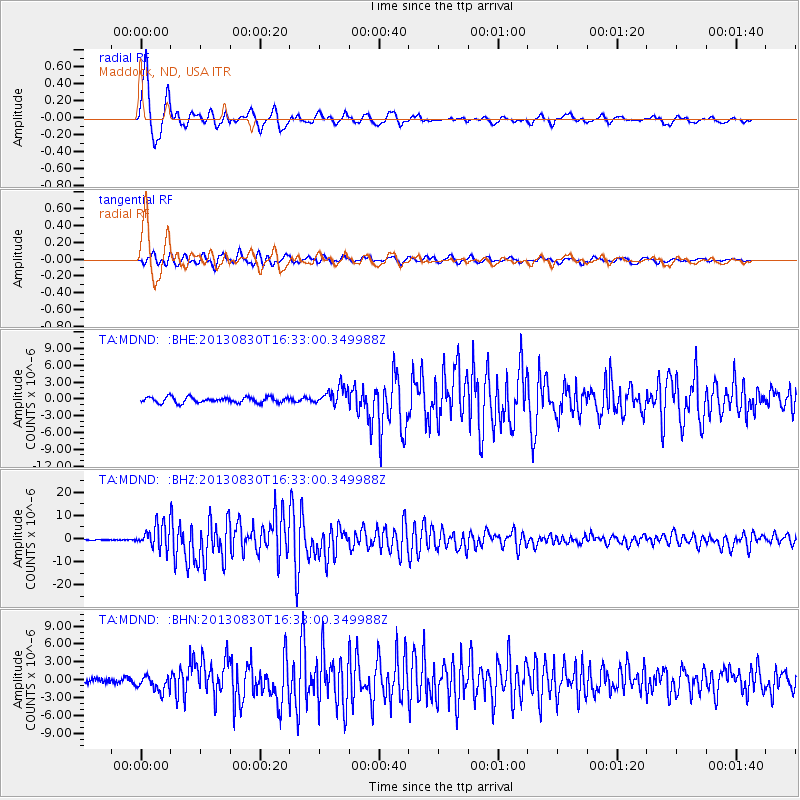
MDND Maddock, ND, USA - Earthquake Result Viewer

Earthquake location: Andreanof Islands, Aleutian Is.
Earthquake latitude/longitude: 51.5/-175.2
Earthquake time(UTC): 2013/08/30 (242) 16:25:02 GMT
Earthquake Depth: 29 km
Earthquake Magnitude: 7.0 MWW, 6.5 ML, 6.8 MI, 6.9 MWC, 6.9 MWB, 7.0 MWW, 7.0 MI, 7.0 MWC
Earthquake Catalog/Contributor: NEIC PDE/NEIC COMCAT
Network: TA USArray Transportable Network (new EarthScope stations)
Station: MDND Maddock, ND, USA
Lat/Lon: 47.85 N/99.60 W
Elevation: 479 m
Distance: 47.0 deg
Az: 63.098 deg
Baz: 304.218 deg
Ray Param: 0.0702093
Estimated Moho Depth: 26.0 km
Estimated Crust Vp/Vs: 2.07
Assumed Crust Vp: 6.53 km/s
Estimated Crust Vs: 3.155 km/s
Estimated Crust Poisson's Ratio: 0.35
Radial Match: 95.543846 %
Radial Bump: 397
Transverse Match: 90.253555 %
Transverse Bump: 400
SOD ConfigId: 626651
Insert Time: 2014-04-18 05:23:12.316 +0000
GWidth: 2.5
Max Bumps: 400
Tol: 0.001

Signal To Noise

ChannelStoNSTALTA
TA:MDND: :BHZ:20130830T16:33:00.349988Z24.7909815.1221195E-62.0661221E-7
TA:MDND: :BHN:20130830T16:33:00.349988Z2.83774761.3574651E-64.7836005E-7
TA:MDND: :BHE:20130830T16:33:00.349988Z3.1975771.6067742E-65.024974E-7
Arrivals
Ps4.5 SECOND
PpPs12 SECOND
PsPs/PpSs16 SECOND