N23A Red Feather Lakes, CO, USA - Earthquake Result Viewer
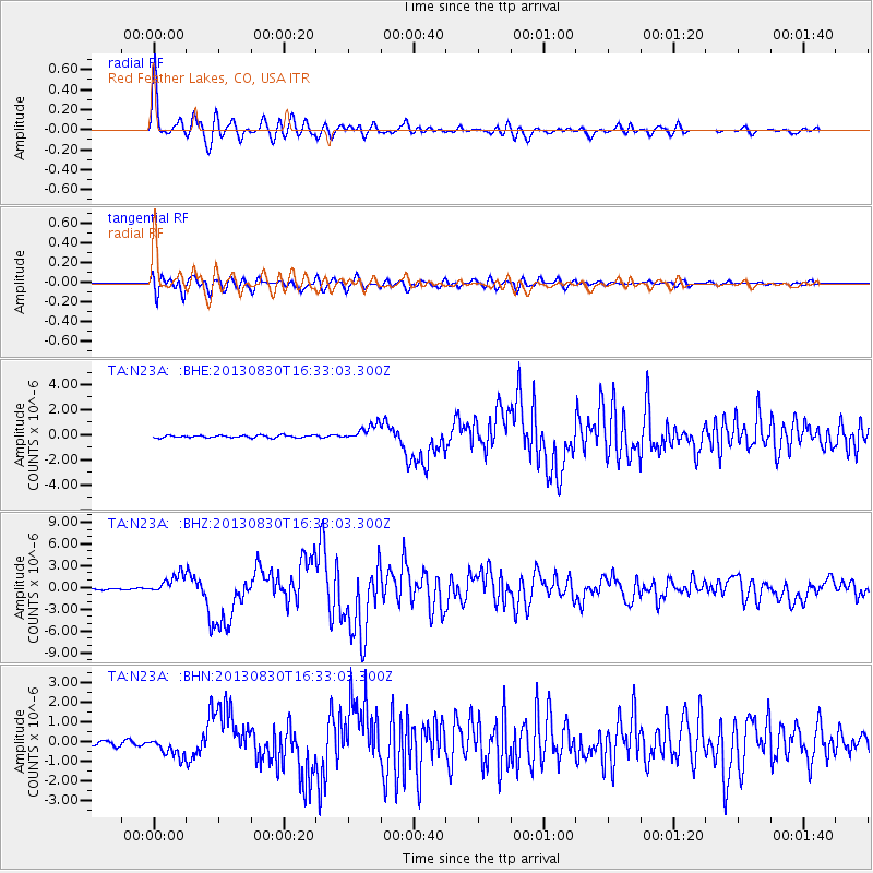
Earthquake location: Andreanof Islands, Aleutian Is.
Earthquake latitude/longitude: 51.5/-175.2
Earthquake time(UTC): 2013/08/30 (242) 16:25:02 GMT
Earthquake Depth: 29 km
Earthquake Magnitude: 7.0 MWW, 6.5 ML, 6.8 MI, 6.9 MWC, 6.9 MWB, 7.0 MWW, 7.0 MI, 7.0 MWC
Earthquake Catalog/Contributor: NEIC PDE/NEIC COMCAT
Network: TA USArray Transportable Network (new EarthScope stations)
Station: N23A Red Feather Lakes, CO, USA
Lat/Lon: 40.89 N/105.94 W
Elevation: 2458 m
Distance: 47.4 deg
Az: 74.405 deg
Baz: 307.482 deg
Ray Param: 0.06995595
Estimated Moho Depth: 53.25 km
Estimated Crust Vp/Vs: 1.69
Assumed Crust Vp: 6.306 km/s
Estimated Crust Vs: 3.737 km/s
Estimated Crust Poisson's Ratio: 0.23
Radial Match: 94.26492 %
Radial Bump: 400
Transverse Match: 78.375404 %
Transverse Bump: 400
SOD ConfigId: 626651
Insert Time: 2014-04-18 05:23:20.508 +0000
GWidth: 2.5
Max Bumps: 400
Tol: 0.001

Signal To Noise

ChannelStoNSTALTA
TA:N23A: :BHZ:20130830T16:33:03.300Z16.5401121.3593478E-68.218492E-8
TA:N23A: :BHN:20130830T16:33:03.300Z3.93787244.917326E-71.2487266E-7
TA:N23A: :BHE:20130830T16:33:03.300Z6.78119376.378497E-79.406156E-8
Arrivals
Ps6.2 SECOND
PpPs21 SECOND
PsPs/PpSs28 SECOND