N60A Cedar Hill Farm, Mount Bethel, PA, USA - Earthquake Result Viewer
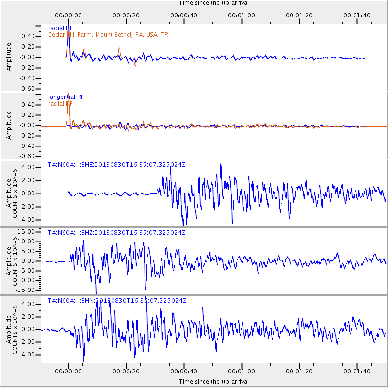
Earthquake location: Andreanof Islands, Aleutian Is.
Earthquake latitude/longitude: 51.5/-175.2
Earthquake time(UTC): 2013/08/30 (242) 16:25:02 GMT
Earthquake Depth: 29 km
Earthquake Magnitude: 7.0 MWW, 6.5 ML, 6.8 MI, 6.9 MWC, 6.9 MWB, 7.0 MWW, 7.0 MI, 7.0 MWC
Earthquake Catalog/Contributor: NEIC PDE/NEIC COMCAT
Network: TA USArray Transportable Network (new EarthScope stations)
Station: N60A Cedar Hill Farm, Mount Bethel, PA, USA
Lat/Lon: 40.87 N/75.10 W
Elevation: 189 m
Distance: 64.8 deg
Az: 55.594 deg
Baz: 317.196 deg
Ray Param: 0.058646463
Estimated Moho Depth: 40.0 km
Estimated Crust Vp/Vs: 1.80
Assumed Crust Vp: 6.283 km/s
Estimated Crust Vs: 3.5 km/s
Estimated Crust Poisson's Ratio: 0.27
Radial Match: 98.11956 %
Radial Bump: 347
Transverse Match: 87.42002 %
Transverse Bump: 400
SOD ConfigId: 626651
Insert Time: 2014-04-18 05:23:58.448 +0000
GWidth: 2.5
Max Bumps: 400
Tol: 0.001

Signal To Noise

ChannelStoNSTALTA
TA:N60A: :BHZ:20130830T16:35:07.325024Z25.6746563.2309824E-61.2584326E-7
TA:N60A: :BHN:20130830T16:35:07.325024Z4.9016841.0316544E-62.1046938E-7
TA:N60A: :BHE:20130830T16:35:07.325024Z6.1446369.805956E-71.5958562E-7
Arrivals
Ps5.3 SECOND
PpPs17 SECOND
PsPs/PpSs22 SECOND