
O48A Farmland, IN, USA - Earthquake Result Viewer
| ||||||||||||||||||
| ||||||||||||||||||
| ||||||||||||||||||
|
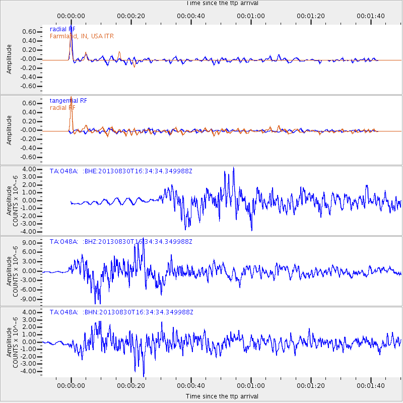
Signal To Noise
| Channel | StoN | STA | LTA |
| TA:O48A: :BHZ:20130830T16:34:34.349988Z | 18.578386 | 2.4615017E-6 | 1.3249276E-7 |
| TA:O48A: :BHN:20130830T16:34:34.349988Z | 6.7725244 | 9.655391E-7 | 1.425671E-7 |
| TA:O48A: :BHE:20130830T16:34:34.349988Z | 4.1233635 | 1.0602231E-6 | 2.571258E-7 |
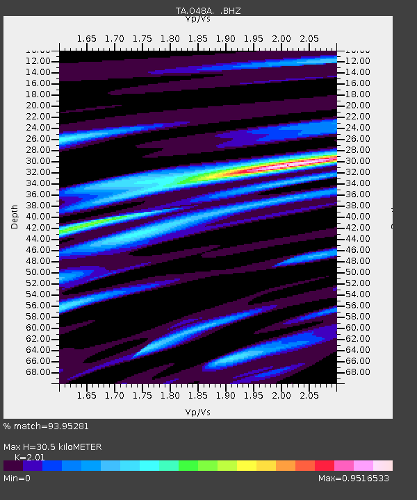
| Arrivals | |
| Ps | 4.9 SECOND |
| PpPs | 14 SECOND |
| PsPs/PpSs | 18 SECOND |

