O56A Blue Knob State Park, Imler, PA, USA - Earthquake Result Viewer
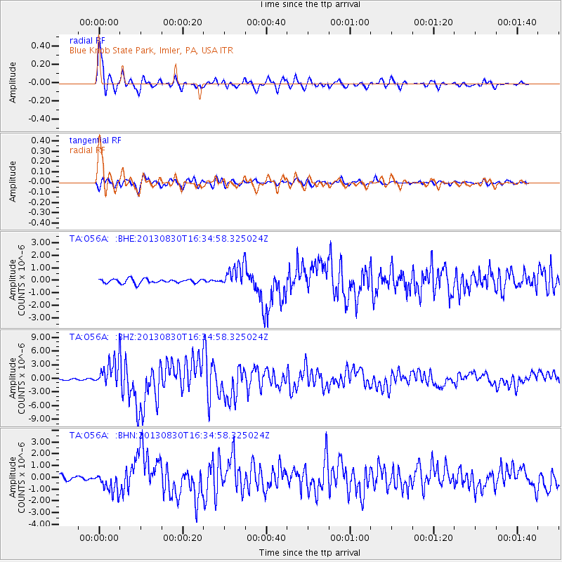
Earthquake location: Andreanof Islands, Aleutian Is.
Earthquake latitude/longitude: 51.5/-175.2
Earthquake time(UTC): 2013/08/30 (242) 16:25:02 GMT
Earthquake Depth: 29 km
Earthquake Magnitude: 7.0 MWW, 6.5 ML, 6.8 MI, 6.9 MWC, 6.9 MWB, 7.0 MWW, 7.0 MI, 7.0 MWC
Earthquake Catalog/Contributor: NEIC PDE/NEIC COMCAT
Network: TA USArray Transportable Network (new EarthScope stations)
Station: O56A Blue Knob State Park, Imler, PA, USA
Lat/Lon: 40.27 N/78.57 W
Elevation: 684 m
Distance: 63.4 deg
Az: 58.187 deg
Baz: 316.082 deg
Ray Param: 0.059541512
Estimated Moho Depth: 41.5 km
Estimated Crust Vp/Vs: 1.80
Assumed Crust Vp: 6.121 km/s
Estimated Crust Vs: 3.396 km/s
Estimated Crust Poisson's Ratio: 0.28
Radial Match: 95.56087 %
Radial Bump: 400
Transverse Match: 87.168945 %
Transverse Bump: 400
SOD ConfigId: 626651
Insert Time: 2014-04-18 05:24:27.618 +0000
GWidth: 2.5
Max Bumps: 400
Tol: 0.001

Signal To Noise

ChannelStoNSTALTA
TA:O56A: :BHZ:20130830T16:34:58.325024Z17.591512.9657815E-61.6859164E-7
TA:O56A: :BHN:20130830T16:34:58.325024Z4.63751278.9669476E-71.9335683E-7
TA:O56A: :BHE:20130830T16:34:58.325024Z5.5945459.4538984E-71.6898422E-7
Arrivals
Ps5.7 SECOND
PpPs18 SECOND
PsPs/PpSs24 SECOND