P46A Rosedale, IN, USA - Earthquake Result Viewer
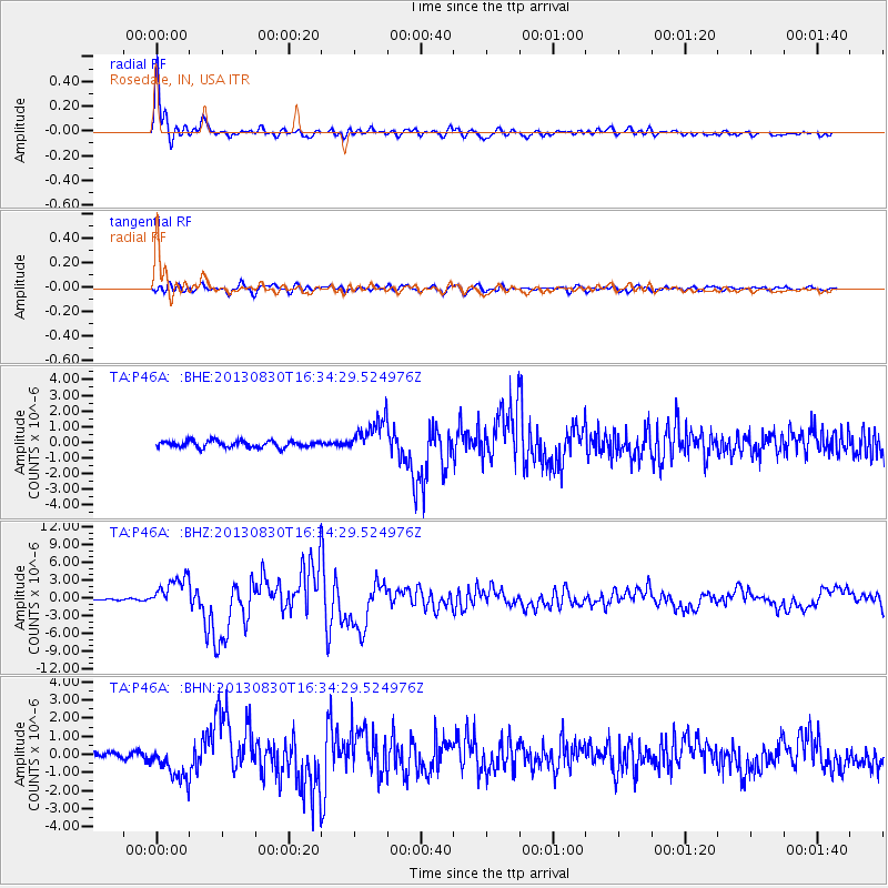
Earthquake location: Andreanof Islands, Aleutian Is.
Earthquake latitude/longitude: 51.5/-175.2
Earthquake time(UTC): 2013/08/30 (242) 16:25:02 GMT
Earthquake Depth: 29 km
Earthquake Magnitude: 7.0 MWW, 6.5 ML, 6.8 MI, 6.9 MWC, 6.9 MWB, 7.0 MWW, 7.0 MI, 7.0 MWC
Earthquake Catalog/Contributor: NEIC PDE/NEIC COMCAT
Network: TA USArray Transportable Network (new EarthScope stations)
Station: P46A Rosedale, IN, USA
Lat/Lon: 39.62 N/87.21 W
Elevation: 194 m
Distance: 59.2 deg
Az: 64.038 deg
Baz: 313.365 deg
Ray Param: 0.062325697
Estimated Moho Depth: 50.25 km
Estimated Crust Vp/Vs: 1.88
Assumed Crust Vp: 6.444 km/s
Estimated Crust Vs: 3.437 km/s
Estimated Crust Poisson's Ratio: 0.30
Radial Match: 96.934784 %
Radial Bump: 400
Transverse Match: 84.44435 %
Transverse Bump: 400
SOD ConfigId: 626651
Insert Time: 2014-04-18 05:24:42.175 +0000
GWidth: 2.5
Max Bumps: 400
Tol: 0.001

Signal To Noise

ChannelStoNSTALTA
TA:P46A: :BHZ:20130830T16:34:29.524976Z20.2157732.6867594E-61.3290412E-7
TA:P46A: :BHN:20130830T16:34:29.524976Z5.2881279.620079E-71.8191845E-7
TA:P46A: :BHE:20130830T16:34:29.524976Z5.2764771.0984413E-62.0817703E-7
Arrivals
Ps7.1 SECOND
PpPs21 SECOND
PsPs/PpSs29 SECOND