
P53A Whipple, OH, USA - Earthquake Result Viewer
| ||||||||||||||||||
| ||||||||||||||||||
| ||||||||||||||||||
|
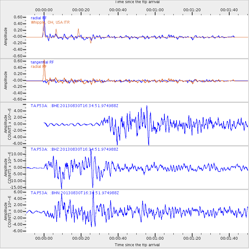
Signal To Noise
| Channel | StoN | STA | LTA |
| TA:P53A: :BHZ:20130830T16:34:51.974988Z | 13.062408 | 2.491572E-6 | 1.907437E-7 |
| TA:P53A: :BHN:20130830T16:34:51.974988Z | 4.3963385 | 8.6573976E-7 | 1.969229E-7 |
| TA:P53A: :BHE:20130830T16:34:51.974988Z | 3.826034 | 9.1845095E-7 | 2.40053E-7 |
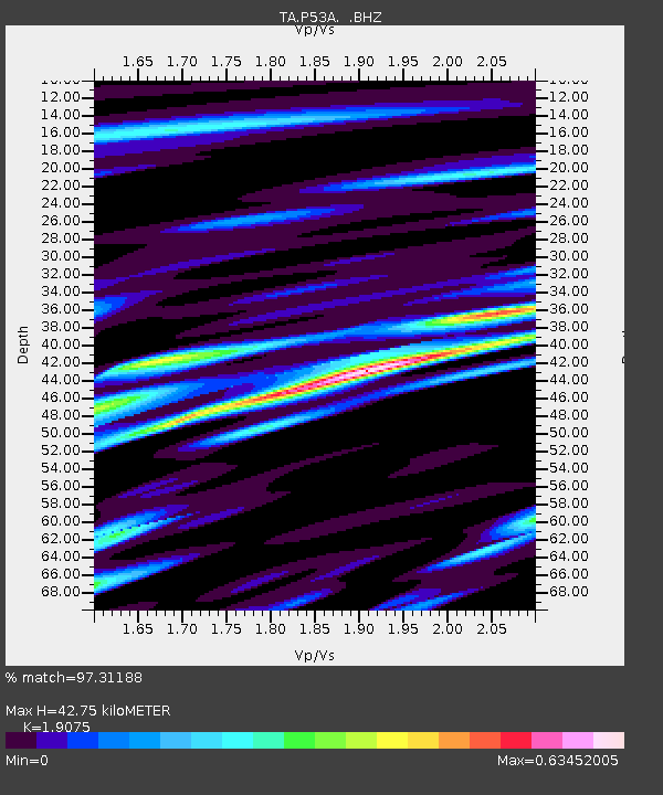
| Arrivals | |
| Ps | 6.5 SECOND |
| PpPs | 19 SECOND |
| PsPs/PpSs | 26 SECOND |

