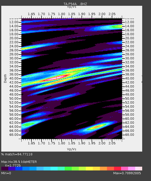
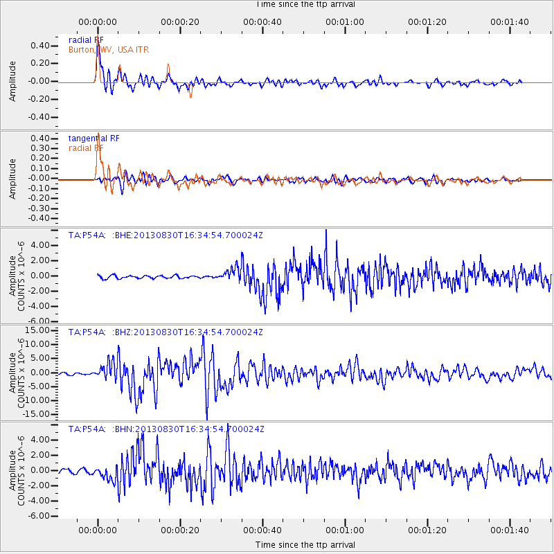
P54A Burton, WV, USA - Earthquake Result Viewer

Earthquake location: Andreanof Islands, Aleutian Is.
Earthquake latitude/longitude: 51.5/-175.2
Earthquake time(UTC): 2013/08/30 (242) 16:25:02 GMT
Earthquake Depth: 29 km
Earthquake Magnitude: 7.0 MWW, 6.5 ML, 6.8 MI, 6.9 MWC, 6.9 MWB, 7.0 MWW, 7.0 MI, 7.0 MWC
Earthquake Catalog/Contributor: NEIC PDE/NEIC COMCAT
Network: TA USArray Transportable Network (new EarthScope stations)
Station: P54A Burton, WV, USA
Lat/Lon: 39.61 N/80.48 W
Elevation: 473 m
Distance: 62.9 deg
Az: 59.884 deg
Baz: 315.625 deg
Ray Param: 0.059898823
Estimated Moho Depth: 39.5 km
Estimated Crust Vp/Vs: 1.77
Assumed Crust Vp: 6.207 km/s
Estimated Crust Vs: 3.502 km/s
Estimated Crust Poisson's Ratio: 0.27
Radial Match: 94.77118 %
Radial Bump: 400
Transverse Match: 84.323944 %
Transverse Bump: 400
SOD ConfigId: 626651
Insert Time: 2014-04-18 05:25:00.322 +0000
GWidth: 2.5
Max Bumps: 400
Tol: 0.001

Signal To Noise

ChannelStoNSTALTA
TA:P54A: :BHZ:20130830T16:34:54.700024Z11.9270253.233276E-62.7108823E-7
TA:P54A: :BHN:20130830T16:34:54.700024Z2.74243129.017136E-73.2880084E-7
TA:P54A: :BHE:20130830T16:34:54.700024Z4.66619738.6606366E-71.8560372E-7
Arrivals
Ps5.1 SECOND
PpPs17 SECOND
PsPs/PpSs22 SECOND